
IMAGES TAKEN NEAR TO
Ryelands Orchard, LEOMINSTER, HR6 8QQ
Introduction
This page details the photographs taken nearby to Ryelands Orchard, HR6 8QQ by members of the Geograph project.
The Geograph project started in 2005 with the aim of publishing, organising and preserving representative images for every square kilometre of Great Britain, Ireland and the Isle of Man.

There are currently over 7.5m images from over14,400 individuals and you can help contribute to the project by visiting https://www.geograph.org.uk
Image Map
Images are licensed for reuse under creativecommons.org/licenses/by-sa/2.0
Notes
- Clicking on the map will re-center to the selected point.
- The higher the marker number, the further away the image location is from the centre of the postcode.
Image Listing (9 Images Found)
Images are licensed for reuse under creativecommons.org/licenses/by-sa/2.0
Image
Details
Distance
1
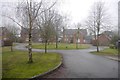
Ryelands Orchard
Residential cul de sac, Leominster.
Image: © Richard Webb
Taken: 27 Dec 2019
0.02 miles
2
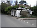
White House on a Hill
This house on the road into Leominster from Ivington looks like an old toll house or a former estate lodge.
Image: © Michael Patterson
Taken: 12 Apr 2006
0.04 miles
3
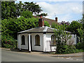
Old Toll House by Ryelands Road, Leominster
Toll House in the parish of Leominster (Herefordshire District), The Lodge, Ryelands Road.
Grade II listed.
List Entry Number: 1255484 https://historicengland.org.uk/listing/the-list/list-entry/1255484
Surveyed
Milestone Society National ID: HF.LEO02
Image: © Alan Rosevear
Taken: 23 May 2006
0.04 miles
4
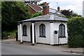
Lodge or toll house in Leominster
Lodge or former toll house on Ryelands Road in Leominster. The building is Grade II listed.
Historic England description
Lodge or tollhouse. Late C18/early C19. Stucco; faceted Welsh slate roof; central brick ridge stack. Single storey; 2-window range: mullion windows with "Gothick" heads and leaded lights, flanking C20 six-panel door and "Gothick" overlight; flat bowed wood hood on 2 Tuscan columns and square pilasters. Similar windows to returned sides. INTERIOR not inspected.
Source: https://historicengland.org.uk/listing/the-list/list-entry/1255484
Image: © Philip Halling
Taken: 23 Jul 2016
0.05 miles
5
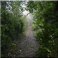
Cockcroft Lane
A green lane on the edge of Leominster - no doubt soon to be in Leominster.
Image: © Richard Webb
Taken: 27 Dec 2019
0.06 miles
6
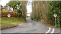
Ryelands Road
The lane from Ivington, leading into Leominster from the south.
Image: © Jonathan Billinger
Taken: 2 Feb 2018
0.09 miles
7
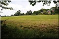
Field at Newland, Leominster
A footpath crosses this field at Newland on the edge of Leominster.
Image: © Philip Halling
Taken: 23 Jul 2016
0.17 miles
8
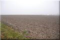
Hill top field, Ryelands, Leominster
Probably lined up for future housing development.
Image: © Richard Webb
Taken: 27 Dec 2019
0.18 miles
9
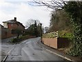
Ryelands Road
Leaving Leominster for Ivington.
Image: © Richard Webb
Taken: 15 Feb 2014
0.21 miles