1
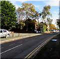
Coningsby Road flats, Leominster
On the south side of the road, east of the B4361 South Street.
Image: © Jaggery
Taken: 16 Oct 2019
0.00 miles
2
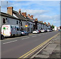
East along Coningsby Road, Leominster
From South Street, Coningsby Road leads to Eaton Close.
Image: © Jaggery
Taken: 16 Oct 2019
0.02 miles
3
5 mph speed limit at the entrance to Cambian Hereford School, Leominster
On the north side on Coningsby Road.
Image: © Jaggery
Taken: 16 Oct 2019
0.02 miles
4
Leominster Moravian Church
Viewed across South Street. The nameboard http://www.geograph.org.uk/photo/3816962 shows that the church has been here since 1759.
Image: © Jaggery
Taken: 22 Apr 2012
0.03 miles
5
Cennick Court, Leominster
Flats on the corner of South Street and Coningsby Road. A plaque https://www.geograph.org.uk/photo/6311902 on the wall records the official opening of Cennick Court on November 21st 2003 by Bill Wiggin MP.
Image: © Jaggery
Taken: 22 Apr 2012
0.04 miles
6
Cennick Court plaque, Leominster
The Marches Housing Association plaque is on the wall here. https://www.geograph.org.uk/photo/3815805
Image: © Jaggery
Taken: 16 Oct 2019
0.04 miles
7
On-street parking, South Street, Leominster
Parking allowed on the west side of the B4361 South Street.
Double yellow lines on the east side indicate no parking at any time.
Image: © Jaggery
Taken: 16 Oct 2019
0.05 miles
8
Nameboard outside Leominster Moravian Church
Located here. http://www.geograph.org.uk/photo/3816959
Image: © Jaggery
Taken: 22 Apr 2012
0.05 miles
9
Formerly The Black Horse pub, Leominster
Viewed across South Street in April 2012. The white and jet black colours remain as a reminder that this used to be The Black Horse pub.
Image: © Jaggery
Taken: 22 Apr 2012
0.05 miles
10
Canopy on the east side of South Street, Leominster
South Street Stores https://www.geograph.org.uk/photo/6297850 are on the right.
Image: © Jaggery
Taken: 16 Oct 2019
0.05 miles


