
IMAGES TAKEN NEAR TO
Etnam Street, LEOMINSTER, HR6 8AL
Introduction
This page details the photographs taken nearby to Etnam Street, HR6 8AL by members of the Geograph project.
The Geograph project started in 2005 with the aim of publishing, organising and preserving representative images for every square kilometre of Great Britain, Ireland and the Isle of Man.

There are currently over 7.5m images from over14,400 individuals and you can help contribute to the project by visiting https://www.geograph.org.uk
Image Map
Images are licensed for reuse under creativecommons.org/licenses/by-sa/2.0
Notes
- Clicking on the map will re-center to the selected point.
- The higher the marker number, the further away the image location is from the centre of the postcode.
Image Listing (618 Images Found)
Images are licensed for reuse under creativecommons.org/licenses/by-sa/2.0
Image
Details
Distance
1
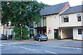
Leominster Museum
Hiding a little behind the tree. It is independent from the local authority and is run by volunteers.
Image: © Bill Boaden
Taken: 2 Aug 2018
0.01 miles
2
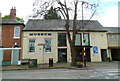
Leominster Folk Museum
Leominster Folk Museum in Etnam Street opened in 1972. The museum has collections of many aretefacts that illustrate local life. Also on display are a Bronze Age burial and a collection of early postage marks and stamps of Leominster.
Image: © Jaggery
Taken: 22 Apr 2012
0.02 miles
3
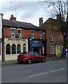
Jalalabad Akbari Cuisine, Leominster
Takeaway at 33 Etnam Street. Next door is Etnam News, newsagents, at number 35.
Image: © Jaggery
Taken: 22 Apr 2012
0.02 miles
4
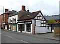
C. Townsend Ltd, Leominster
Premises at 19 Etnam Street of electrical contractors and wholesale electrical suppliers.
Image: © Jaggery
Taken: 22 Apr 2012
0.02 miles
5
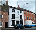
The Bell, Leominster
Pub at 39 Etnam Street.
Image: © Jaggery
Taken: 22 Apr 2012
0.02 miles
6
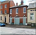
The Old Coach House, Leominster
The unusual doors on this Etnam Street house are a clue that it was formerly a coach house.
Its name is a bigger clue!
Image: © Jaggery
Taken: 22 Apr 2012
0.02 miles
7
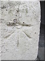
Ordnance Survey Cut Mark
This OS cut mark can be found on the Folk Museum, Etnam Street. It marks a point 75.660m above mean sea level.
Image: © Adrian Dust
Taken: 19 Apr 2014
0.02 miles
8
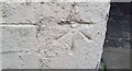
Ordnance Survey Cut Mark
This OS cut mark can be found on the Museum. It marks a point 75.660m above mean sea level.
Image: © Adrian Dust
Taken: 12 Mar 2017
0.02 miles
9
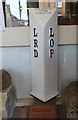
Old Boundary Marker
Parish Boundary Marker now on display in Leominster Museum. Formerly on the boundary of Leominster Rural District and Leominster Out Parish. In raised lettering L / R /D (Leominster Rural District) on the left, L / O / P (Leominster Out Parish) on the right and BELLOW & SON / MAKERS / LEOMINSTER on its top.
Milestone Society National ID: HF_LEOM03pb
Image: © Mr Red
Taken: 6 Sep 2019
0.02 miles
10
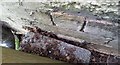
Ordnance Survey Flush Bracket (G3452)
This OS Flush Bracket (Top Edge) can be found on the Museum. It marks a point 75.383m above mean sea level.
Image: © Adrian Dust
Taken: 12 Mar 2017
0.02 miles