
IMAGES TAKEN NEAR TO
Worcester Road, LEOMINSTER, HR6 0QQ
Introduction
This page details the photographs taken nearby to Worcester Road, HR6 0QQ by members of the Geograph project.
The Geograph project started in 2005 with the aim of publishing, organising and preserving representative images for every square kilometre of Great Britain, Ireland and the Isle of Man.

There are currently over 7.5m images from over14,400 individuals and you can help contribute to the project by visiting https://www.geograph.org.uk
Image Map
Images are licensed for reuse under creativecommons.org/licenses/by-sa/2.0
Notes
- Clicking on the map will re-center to the selected point.
- The higher the marker number, the further away the image location is from the centre of the postcode.
Image Listing (82 Images Found)
Images are licensed for reuse under creativecommons.org/licenses/by-sa/2.0
Image
Details
Distance
1
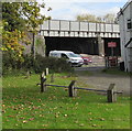
South side of a railway bridge, Leominster
Over the Welsh Marches Line railway about 450 metres south of Leominster station.
Image: © Jaggery
Taken: 16 Oct 2019
0.01 miles
2
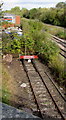
Railway siding alongside the Welsh Marches Line, Leominster
About 450 metres south of Leominster railway station.
Image: © Jaggery
Taken: 16 Oct 2019
0.02 miles
3
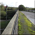
Semaphore signal alongside the Welsh Marches Line, Leominster
The signal is operated from this https://www.geograph.org.uk/photo/6302355 nearby signalbox.
Image: © Jaggery
Taken: 16 Oct 2019
0.02 miles
4
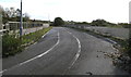
Across a railway bridge, Leominster
Between Worcester Road and the A49 Leominster Bypass, the bridge carries a combined footpath and cycle route over the Welsh Marches Line railway about 450 metres south of Leominster railway station.
Image: © Jaggery
Taken: 16 Oct 2019
0.02 miles
5
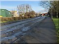
Worcester Road (Leominster)
I remember cycling on the paths here to the Industrial Estate and back from 2012-16. In the distance to the left is BPI, which I personally nickname "Leominster's Bad Luck" for many reasons. It used to make an irritating hum sound all day that was heard by residents living in the housing by it (including my family until April 2017), and it turns out it was built in the late 2000s so I didn't cope with that sound for the first few years of my life!
Image: © Fabian Musto
Taken: 3 Feb 2021
0.03 miles
6
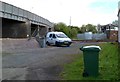
Leominster Signalbox
Viewed through a Sunnyside fence. The signalbox is about 500 metres SSE of Leominster railway station. The bridge carries a footpath and cycleway over the tracks.
Image: © Jaggery
Taken: 22 Apr 2012
0.03 miles
7
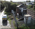
Steps up to a signalbox, Leominster
The box is on the left here. https://www.geograph.org.uk/photo/6302349
Image: © Jaggery
Taken: 16 Oct 2019
0.03 miles
8
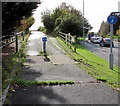
Footpath and cycle route in Leominster
From Worcester Road to the A49 Leominster Bypass via a railway bridge.
Image: © Jaggery
Taken: 16 Oct 2019
0.03 miles
9
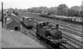
GW 0-4-2T in the Goods yard at Leominster
View northward, towards Leominster station, Ludlow and Shrewsbury: ex-GW & LNW Joint Shrewsbury - Hereford main line, formerly junction of branches from Worcester via Bromyard (closed 15/9/52) and New Radnor via Kington (closed in stages up to 7/2/55 (goods 28/9/64). The auto-fitted 0-4-2T, No. 1420 (built as 4820 11/33, renumbered 11/46, withdrawn 11/64) is preserved on the South Devon Railway - see Image
Image: © Ben Brooksbank
Taken: 13 Aug 1963
0.04 miles
10

Hintons Country & Garden Self Storage (Leominster)
Situated on Station Yard Industrial Estate is Hintons, a self-storage facility that is adjacent to St. Michael's Hospice and the railway station.
Image: © Fabian Musto
Taken: 3 Feb 2021
0.04 miles