
IMAGES TAKEN NEAR TO
Wharton, LEOMINSTER, HR6 0NY
Introduction
This page details the photographs taken nearby to HR6 0NY by members of the Geograph project.
The Geograph project started in 2005 with the aim of publishing, organising and preserving representative images for every square kilometre of Great Britain, Ireland and the Isle of Man.

There are currently over 7.5m images from over14,400 individuals and you can help contribute to the project by visiting https://www.geograph.org.uk
Image Map
Images are licensed for reuse under creativecommons.org/licenses/by-sa/2.0
Notes
- Clicking on the map will re-center to the selected point.
- The higher the marker number, the further away the image location is from the centre of the postcode.
Image Listing (57 Images Found)
Images are licensed for reuse under creativecommons.org/licenses/by-sa/2.0
Image
Details
Distance
1
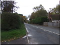
Hereford Road (B4361), Wharton
Towards Leominster.
Image: © JThomas
Taken: 2 Nov 2019
0.04 miles
3
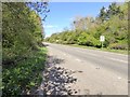
A49 looking north from lay-by near Wharton
Image: © David Smith
Taken: 22 Apr 2015
0.09 miles
4

Railway at Wharton
This service is seen just south of Leominster Station.
Image: © Stuart Wilding
Taken: 4 May 2009
0.14 miles
5
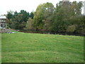
The River Lugg (Ford)
Here is the River Lugg at Ford (Herefordshire), which is viewed from the path that leads up to the entrance at St. John of Jerusalem's Church in the same village.
Image: © Fabian Musto
Taken: 27 Oct 2018
0.19 miles
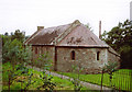
7
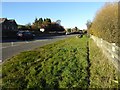
The A49 at Ford
The A49 at this point forms part of the bypass around the town of Leominster, the original road runs parallel with this road beyond the Hereford to Shrewsbury railway line.
Image: © Philip Halling
Taken: 25 Nov 2016
0.19 miles
8
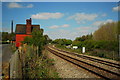
Ford Bridge railway station
The old station at Ford, long closed and now used as a private residence. The old platform edge can just be made out in front of the house. The old and new alignments of the A49 can be seen running either side of the railway. The station was closed in 1954.
Image: © John Winder
Taken: 18 Apr 2014
0.20 miles
9
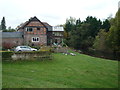
Ford Farm & The River Lugg (Ford)
This splendid farm at Ford (Herefordshire) was built very close-by to the River Lugg, as that can be seen in the right of this photo. Viewed from the path that leads up to the entrance at St. John of Jerusalem's Church in the same village.
Image: © Fabian Musto
Taken: 27 Oct 2018
0.20 miles
10
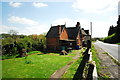
Ford Bridge station house
Another shot of the old railway station at Ford in Hereford (yes, the village is called Ford but the station was called Ford Bridge. I don't know why). Taken from the old A49, now a B road.
Image: © John Winder
Taken: 18 Apr 2014
0.20 miles