
IMAGES TAKEN NEAR TO
Luston, LEOMINSTER, HR6 0EG
Introduction
This page details the photographs taken nearby to HR6 0EG by members of the Geograph project.
The Geograph project started in 2005 with the aim of publishing, organising and preserving representative images for every square kilometre of Great Britain, Ireland and the Isle of Man.

There are currently over 7.5m images from over14,400 individuals and you can help contribute to the project by visiting https://www.geograph.org.uk
Image Map
Images are licensed for reuse under creativecommons.org/licenses/by-sa/2.0
Notes
- Clicking on the map will re-center to the selected point.
- The higher the marker number, the further away the image location is from the centre of the postcode.
Image Listing (15 Images Found)
Images are licensed for reuse under creativecommons.org/licenses/by-sa/2.0
Image
Details
Distance
1
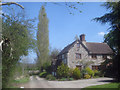
House at Blackpole
Large house in a very secluded location at the end of the track.
Image: © Trevor Rickard
Taken: 20 Apr 2009
0.04 miles
2
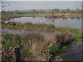
Pond at Blackpole - 2
Looking north-west across flat farmland with Croft Ambrey hills in the distance.
Image: © Trevor Rickard
Taken: 20 Apr 2009
0.05 miles
3
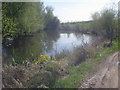
Another pond at Blackpole
Looking south over the pond which is marked on the OS map. Marsh Marigold blooming in the foreground.
Image: © Trevor Rickard
Taken: 20 Apr 2009
0.05 miles
4
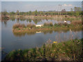
Pond at Blackpole - 1
Looking north-east across a large pond, not shown on the OS map. Home to a swan who would live a very quiet life except for the occasional train on the embankment at the bask. Berrington Hall parkland on the hill beyond.
Image: © Trevor Rickard
Taken: 20 Apr 2009
0.05 miles
5
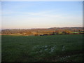
Near Luston
From near Bury Farm looking north-east across the valley to Eye (extreme left) and Berrington.
Image: © Raymond Perry
Taken: 20 Nov 2005
0.11 miles
6
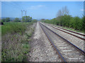
Main line at Blackpole
Looking north along the straight section of track which heads towards Ludlow on the Hereford-to-Shrewsbury line.
Image: © Trevor Rickard
Taken: 20 Apr 2009
0.15 miles
7
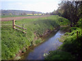
Ridgemoor Brook - 1
Looking south and downstream from the public footpath. Lots of water weed and clear water, which looks to be a good habitat for water voles. Long Wood in the distance.
Image: © Trevor Rickard
Taken: 20 Apr 2009
0.17 miles
8
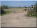
Track junction near Blackpole
Looking north at a junction of farm tracks. The finger post indicates the public rights of way.
Image: © Trevor Rickard
Taken: 20 Apr 2009
0.18 miles
9
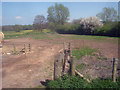
Footpath east of Blackpole
Looking eastwards across flat farmland. The public footpath heads over the stile and into an impressive crop of dandelions in the next field.
Image: © Trevor Rickard
Taken: 20 Apr 2009
0.18 miles
10
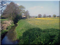
Ridgemoor Brook - 2
Looking northwards towards Eye in the distance. A sea of dandelions on the right.
Image: © Trevor Rickard
Taken: 20 Apr 2009
0.18 miles