
IMAGES TAKEN NEAR TO
Island Terrace, KINGTON, HR5 3DT
Introduction
This page details the photographs taken nearby to Island Terrace, HR5 3DT by members of the Geograph project.
The Geograph project started in 2005 with the aim of publishing, organising and preserving representative images for every square kilometre of Great Britain, Ireland and the Isle of Man.

There are currently over 7.5m images from over14,400 individuals and you can help contribute to the project by visiting https://www.geograph.org.uk
Image Map
Images are licensed for reuse under creativecommons.org/licenses/by-sa/2.0
Notes
- Clicking on the map will re-center to the selected point.
- The higher the marker number, the further away the image location is from the centre of the postcode.
Image Listing (254 Images Found)
Images are licensed for reuse under creativecommons.org/licenses/by-sa/2.0
Image
Details
Distance
1

J Mart Warehouse (Kington)
This wooden series of buildings are placed in Bridge Street near Kington Bridge.
Image: © Fabian Musto
Taken: 30 Jun 2020
0.01 miles
2

The River Arrow (Kington)
This section of the River Arrow by Kington Bridge becomes a mill lade for Arrow Mill, which is out of shot on the right.
Image: © Fabian Musto
Taken: 30 Jun 2020
0.02 miles
3

Mill lades near Arrow Mill (Kington)
The mill lades stream off the River Arrow after Kington Bridge, and after they pass Arrow Mill, they join back up to the River Arrow again.
Image: © Fabian Musto
Taken: 30 Jun 2020
0.02 miles
4

Miller's House, Arrow Mills
Very handsome 18th century mill owner's house next to Arrow Mills.
Image: © Philip Pankhurst
Taken: 6 Jun 2010
0.02 miles
5

Arrow Mill, Kington
A large water mill complex that is now part of a garden centre and contains a microhydropower plant. Sometimes open for National Mills Open Weekend, it wasn't in 2015.
Image: © Chris Allen
Taken: 10 May 2015
0.02 miles
6

St. Bede's Roman Catholic church
Built in 1890 as a Mission Room run by the Church Army for St Mary’s Anglican Parish.
From 1936, when the Mission moved to a new Church Hall built in the Square, the Mission Room continued to be used for various functions.
In the early 1980’s, the old Mission Hall was purchased by St Bede’s Roman Catholic parish.
Image: © Bob Embleton
Taken: 27 Feb 2010
0.03 miles
8
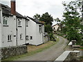
Tanyard Lane, Kington
Just off Bridge Street, next to the River Arrow, which after heavy rainfall gets a lot closer.
Image: © Philip Pankhurst
Taken: 6 Jun 2010
0.03 miles
9

Kingdom Hall
The sign outside says "The Old Picture House 46 Bridge Street", but I believe this was originally the old Primitive Methodist chapel. It was in use by the local 'Jehovah Witness' congregation until the middle of the decade (2005) and still appears in some documents as Kingdom Hall.
Image: © Bob Embleton
Taken: 27 Feb 2010
0.03 miles
10

Ordnance Survey Cut Mark
This OS cut mark can be found on the east parapet of the River Arrow Bridge. It marks a point 154.967m above mean sea level.
Image: © Adrian Dust
Taken: 19 Nov 2015
0.03 miles