
IMAGES TAKEN NEAR TO
Shinwell Road, HEREFORD, HR4 9YL
Introduction
This page details the photographs taken nearby to Shinwell Road, HR4 9YL by members of the Geograph project.
The Geograph project started in 2005 with the aim of publishing, organising and preserving representative images for every square kilometre of Great Britain, Ireland and the Isle of Man.

There are currently over 7.5m images from over14,400 individuals and you can help contribute to the project by visiting https://www.geograph.org.uk
Image Map
Images are licensed for reuse under creativecommons.org/licenses/by-sa/2.0
Notes
- Clicking on the map will re-center to the selected point.
- The higher the marker number, the further away the image location is from the centre of the postcode.
Image Listing (326 Images Found)
Images are licensed for reuse under creativecommons.org/licenses/by-sa/2.0
Image
Details
Distance
1
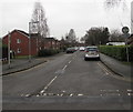
Shinwell Road, Hereford
North along Shinwell Road from Canonmoor Street towards Penhaligon Way.
Image: © Jaggery
Taken: 30 Jan 2017
0.02 miles
2
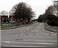
West along Penhaligon Way, Hereford
Viewed across the A49 Edgar Street.
Image: © Jaggery
Taken: 30 Jan 2017
0.03 miles
3
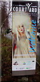
The Courtyard welcome sign, Hereford
Alongside Penhaligon Way on the approach to The Courtyard, http://www.geograph.org.uk/photo/3502437
Herefordshire's Centre for the Arts.
Image: © Jaggery
Taken: 30 Jan 2017
0.04 miles
4
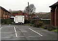
Salvation Army Hereford Emergency Response Unit, Hereford
The two axle trailer is in a corner of the car park on the west side of the Salvation Army Hereford Citadel. http://www.geograph.org.uk/photo/5267914
Salvation Army Emergency Response Units attend events and emergencies, providing hot food and drink for emergency personnel such as the ambulance service, fire service and the police.
Image: © Jaggery
Taken: 30 Jan 2017
0.04 miles
5
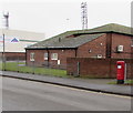
Queen Elizabeth II pillarbox, Penhaligon Way, Hereford
On the left here. http://www.geograph.org.uk/photo/5596491
Image: © Jaggery
Taken: 30 Jan 2017
0.05 miles
6
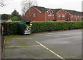
Salvation Army donations bin near Canonmoor Street, Hereford
In a corner of the car park on the west side of the Salvation Army Hereford Citadel. http://www.geograph.org.uk/photo/5267914
Image: © Jaggery
Taken: 30 Jan 2017
0.05 miles
7
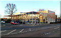
Courtyard Arts Centre, Hereford
Located in Penhaligon Way opposite Edgar Street football ground.
The Courtyard is Herefordshire's Centre for the Arts and the leading arts provider in the county.
There is a 436-seat main house, a 120-seat studio theatre, rehearsal rooms, a gallery, meeting spaces and a cafe bar.
Image: © Jaggery
Taken: 13 Jan 2012
0.05 miles
8
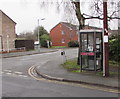
BT phonebox on a Hereford corner
On the corner of Canonmoor Street and Shinwell Road.
Image: © Jaggery
Taken: 30 Jan 2017
0.06 miles
9
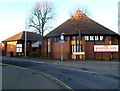
The Salvation Army Hereford Citadel
Located in two interconnected buildings in Canonmoor Street, on the corner of Edgar Street.
Image: © Jaggery
Taken: 13 Jan 2012
0.06 miles
10
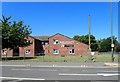
Henffordd Gardens
There are about 30 apartments in this housing scheme for people with dementia and cognitive impairment, over the age of 50.
Image: © Eirian Evans
Taken: 26 Jun 2018
0.06 miles