
IMAGES TAKEN NEAR TO
Gladstone Drive, HEREFORD, HR4 9YD
Introduction
This page details the photographs taken nearby to Gladstone Drive, HR4 9YD by members of the Geograph project.
The Geograph project started in 2005 with the aim of publishing, organising and preserving representative images for every square kilometre of Great Britain, Ireland and the Isle of Man.

There are currently over 7.5m images from over14,400 individuals and you can help contribute to the project by visiting https://www.geograph.org.uk
Image Map
Images are licensed for reuse under creativecommons.org/licenses/by-sa/2.0
Notes
- Clicking on the map will re-center to the selected point.
- The higher the marker number, the further away the image location is from the centre of the postcode.
Image Listing (209 Images Found)
Images are licensed for reuse under creativecommons.org/licenses/by-sa/2.0
Image
Details
Distance
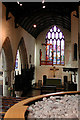
2

View from Hereford Cathedral Tower 3 - NW
Dominated by the storage tanks at Bulmers, the largest is inscribed STRONGBOW.
Next: Image]
Image: © Keith Edkins
Taken: 17 Jul 2013
0.05 miles
3
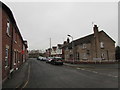
West along Canonmoor Street, Hereford
From the corner of Moorfield Street along Canonmoor Street towards Great Western Court.
Image: © Jaggery
Taken: 30 Jan 2017
0.06 miles
4
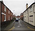
Richmond Street, Hereford
From the west side of Moorfield Street, Richmond Street leads to Brunel Court.
The derelict former Moorfield Inn http://www.geograph.org.uk/photo/5267767 is on the right.
Image: © Jaggery
Taken: 30 Jan 2017
0.08 miles
5
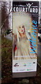
The Courtyard welcome sign, Hereford
Alongside Penhaligon Way on the approach to The Courtyard, http://www.geograph.org.uk/photo/3502437
Herefordshire's Centre for the Arts.
Image: © Jaggery
Taken: 30 Jan 2017
0.11 miles
6
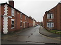
Walmer Street, Hereford
Dead-end street on the west side of Moorfield Street. Caldwell Court http://www.geograph.org.uk/photo/5267723 is on the right.
A stone tablet in the brick wall on the left shows WALMER STREET 1861.
Image: © Jaggery
Taken: 30 Jan 2017
0.12 miles
7
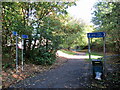
Great Western Way Hereford, junction of two paths
Image: © Roy Hughes
Taken: 18 Oct 2022
0.12 miles
8
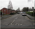
Shinwell Road, Hereford
North along Shinwell Road from Canonmoor Street towards Penhaligon Way.
Image: © Jaggery
Taken: 30 Jan 2017
0.12 miles
9
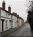
Moorfield Street houses, Hereford
Between Richmond Street and Canonmoor Street.
Image: © Jaggery
Taken: 30 Jan 2017
0.12 miles
10
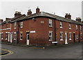
Caxton Place, Hereford
CAXTON PLACE is inscribed on the small concrete rectangle at first
floor level on the corner of Canonmoor Street and Moorfield Street.
Image: © Jaggery
Taken: 30 Jan 2017
0.12 miles