IMAGES TAKEN NEAR TO
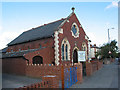
Faraday Road, HEREFORD, HR4 9UW
Introduction
This page details the photographs taken nearby to Faraday Road, HR4 9UW by members of the Geograph project.
The Geograph project started in 2005 with the aim of publishing, organising and preserving representative images for every square kilometre of Great Britain, Ireland and the Isle of Man.

There are currently over 7.5m images from over14,400 individuals and you can help contribute to the project by visiting https://www.geograph.org.uk
Image Map
Images are licensed for reuse under creativecommons.org/licenses/by-sa/2.0
Notes
- Clicking on the map will re-center to the selected point.
- The higher the marker number, the further away the image location is from the centre of the postcode.
Image Listing (36 Images Found)
Images are licensed for reuse under creativecommons.org/licenses/by-sa/2.0
Image
Details
Distance
1
St Mary's Church, Hereford
In Grandstand Road. Built in 1912.
Image: © Pauline E
Taken: 10 Jun 2008
0.06 miles
2
St Mary's Church, Hereford
Viewed across Grandstand Road.
Image: © Jaggery
Taken: 27 Aug 2012
0.07 miles
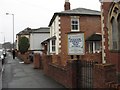
3
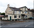
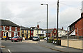
Golden Lion, Hereford
Pub on the corner of Grandstand Road and Golden Lion Close.
Image: © Jaggery
Taken: 27 Aug 2012
0.07 miles
4
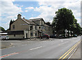
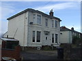
The Golden Lion public house, Hereford
In Grandstand Road.
Image: © Pauline E
Taken: 10 Jun 2008
0.09 miles
5
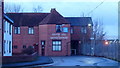
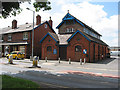
JW's Kingdom Hall
The centre for Hereford's Jehovah's Witnesses.
Image: © Jonathan Billinger
Taken: 9 Feb 2018
0.12 miles
6
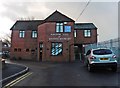
Kingdom Hall of Jehovah's Witnesses, Hereford
Image: © Roger Cornfoot
Taken: 8 Dec 2018
0.12 miles
7
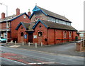
Hall of The Christadelphians, Holmer Road
Image: © Pauline E
Taken: 18 Sep 2007
0.12 miles
8
Holmer Road
Lots of Victorian architecture in Hereford. Looking towards the city down Holmer Road.
Image: © Richard Webb
Taken: 26 Dec 2006
0.15 miles