
IMAGES TAKEN NEAR TO
Holmer Road, HEREFORD, HR4 9RU
Introduction
This page details the photographs taken nearby to Holmer Road, HR4 9RU by members of the Geograph project.
The Geograph project started in 2005 with the aim of publishing, organising and preserving representative images for every square kilometre of Great Britain, Ireland and the Isle of Man.

There are currently over 7.5m images from over14,400 individuals and you can help contribute to the project by visiting https://www.geograph.org.uk
Image Map
Images are licensed for reuse under creativecommons.org/licenses/by-sa/2.0
Notes
- Clicking on the map will re-center to the selected point.
- The higher the marker number, the further away the image location is from the centre of the postcode.
Image Listing (47 Images Found)
Images are licensed for reuse under creativecommons.org/licenses/by-sa/2.0
Image
Details
Distance
1
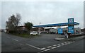
Co-op filling station, Widemarsh, Hereford
Image: © David Smith
Taken: 3 Dec 2021
0.05 miles
2
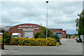
Newey & Eyre, Hereford branch
Electrical wholesalers off Holmer Road, to the north of the city centre.
Image: © Jonathan Billinger
Taken: 7 Jul 2010
0.05 miles
3
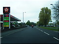
Holmer Road looking north at Texaco filling station
Image: © Colin Pyle
Taken: 7 May 2012
0.06 miles
5
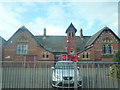
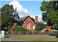
Holmer C. of E. Primary School (Holmer)
Pretty obvious that this school was pulling a "Weeping Window" impression... interesting concept, nevertheless. The poppies were put up in memory of those who had fallen in the First World War almost a century ago.
Image: © Fabian Musto
Taken: 30 Oct 2018
0.06 miles
6
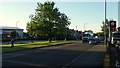
Holmer Road, 2
The A49 looking south, towards Hereford city centre.
Image: © Jonathan Billinger
Taken: 13 Sep 2017
0.06 miles
7
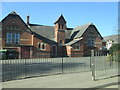
Holmer C. of E. Primary School (Holmer)
Taken from my car window. I took this quite a while back actually, and forgot to upload it until now.
Image: © Fabian Musto
Taken: 25 Feb 2018
0.06 miles
8
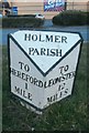
Old Milepost by the A49, Holmer Road, Hereford
Cast iron post by the A49, in parish of HEREFORD (District), Holmer Road, opposite warehouse, on verge by bus shelter, facing away from the A49. Hodges iron T-post, erected by the Hereford turnpike trust in the 19th century.
Inscription reads:-
: TO / HEREFORD / 1 / MILE : : HOLMER / PARISH : : TO / LEOM'STER / 12 / MILES :
Herefordshire SMR.
SMR Number: 56606 https://www.heritagegateway.org.uk/Gateway/Results_Single.aspx?uid=MHE28362&resourceID=101
Milestone Society National ID: HF_HFLM01.
Image: © Robert Walker
Taken: 15 Oct 2012
0.07 miles
9
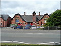
Holmer C. of E. Primary School
Adjacent to the A49 Holmer Road, to the north of Hereford city centre.
Image: © Jonathan Billinger
Taken: 7 Jul 2010
0.07 miles
10
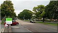
Holmer Road, 1
The A49 looking north, away from Hereford city centre.
Image: © Jonathan Billinger
Taken: 11 Sep 2017
0.08 miles