
IMAGES TAKEN NEAR TO
Chandos Street, HEREFORD, HR4 0EY
Introduction
This page details the photographs taken nearby to Chandos Street, HR4 0EY by members of the Geograph project.
The Geograph project started in 2005 with the aim of publishing, organising and preserving representative images for every square kilometre of Great Britain, Ireland and the Isle of Man.

There are currently over 7.5m images from over14,400 individuals and you can help contribute to the project by visiting https://www.geograph.org.uk
Image Map
Images are licensed for reuse under creativecommons.org/licenses/by-sa/2.0
Notes
- Clicking on the map will re-center to the selected point.
- The higher the marker number, the further away the image location is from the centre of the postcode.
Image Listing (85 Images Found)
Images are licensed for reuse under creativecommons.org/licenses/by-sa/2.0
Image
Details
Distance
1
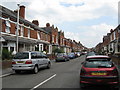
Hereford Street Scene (1)
Part of a large area of housing developed in the 1880s and 1890s, with most houses bearing an individual date stone. Well worth exploring.
Image: © Peter Whatley
Taken: 29 Jun 2009
0.01 miles
2
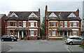
42-48 Chandos Street, Hereford
Two pairs of semis by Thomas Nicholson, 1883.
Image: © Stephen Richards
Taken: 23 Jun 2017
0.01 miles
3
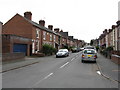
Stanhope Street
Part of a large area of housing developed in the 1880s and 1890s, with most houses bearing an individual date stone. Well worth exploring.
Image: © Peter Whatley
Taken: 29 Jun 2009
0.04 miles
4
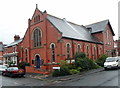
Chandos Street Methodist Church, Hereford
On the corner of Chandos Street and White Horse Street.
Image: © Jaggery
Taken: 27 Aug 2012
0.07 miles
5
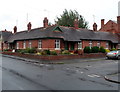
Jubilee Almshouses, Hereford
Late Victorian almshouses on the corner of Chandos Street and White Horse Street, opposite Chandos Street Methodist Church. http://www.geograph.org.uk/photo/3524955
A tablet http://www.geograph.org.uk/photo/3525031 depicting stag and verderers shows the year 1887, the Golden Jubilee of Queen Victoria.
Image: © Jaggery
Taken: 27 Aug 2012
0.07 miles
6
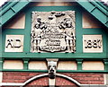
Jubilee Almshouses tablet, Hereford
The tablet is on the White Horse Street side of the almshouses. http://www.geograph.org.uk/photo/3525023
Image: © Jaggery
Taken: 27 Aug 2012
0.08 miles
7
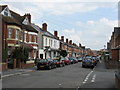
Hereford Street Scene (2)
Taken at the junction with Stanhope Road. Part of a large area of housing developed in the 1880s and 1890s, with most houses bearing an individual date stone. Well worth exploring.
Image: © Peter Whatley
Taken: 29 Jun 2009
0.09 miles
8
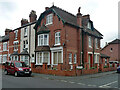
1 Cornewall Street, Hereford
By W.W. Robinson, 1889. It exhibits just about enough eccentricity to lift it slightly above bog standard Victorian suburban fare, e.g. the eaves brackets and dormer.
Image: © Stephen Richards
Taken: 23 Jun 2017
0.09 miles
9
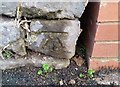
Ordnance Survey Cut Mark
This OS cut mark can be found on the wall of No60 Ryelands Street. It marks a point 57.339m above mean sea level.
Image: © Adrian Dust
Taken: 10 Mar 2019
0.10 miles
10
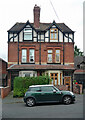
51-53 White Horse Street, Hereford
A late Victorian pair with some mildly interesting features, probably not by W.W. Robinson who worked on much of the street.
Image: © Stephen Richards
Taken: 23 Jun 2017
0.10 miles