
IMAGES TAKEN NEAR TO
Barton Yard, HEREFORD, HR4 0AX
Introduction
This page details the photographs taken nearby to Barton Yard, HR4 0AX by members of the Geograph project.
The Geograph project started in 2005 with the aim of publishing, organising and preserving representative images for every square kilometre of Great Britain, Ireland and the Isle of Man.

There are currently over 7.5m images from over14,400 individuals and you can help contribute to the project by visiting https://www.geograph.org.uk
Image Map
Images are licensed for reuse under creativecommons.org/licenses/by-sa/2.0
Notes
- Clicking on the map will re-center to the selected point.
- The higher the marker number, the further away the image location is from the centre of the postcode.
Image Listing (615 Images Found)
Images are licensed for reuse under creativecommons.org/licenses/by-sa/2.0
Image
Details
Distance
1
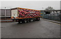
Sainsbury's lorry, Grimmer Road, Hereford
After delivering new stock to the nearby Sainsbury's, the articulated
lorry is travelling north along Grimmer Road towards the A438.
Image: © Jaggery
Taken: 30 Jan 2017
0.03 miles
2
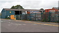
Travis Perkins, Hereford
Located in Barton Sidings, north of Station Road and Barton Road.
This is one of more than 600 Travis Perkins builders' merchants' premises in the UK.
Image: © Jaggery
Taken: 27 Aug 2012
0.03 miles
3
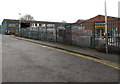
Travis Perkins, Hereford
Located in Barton Sidings, viewed from Station Road. This location is not near the present-day Hereford railway station. The 19th century Hereford Barton railway station used to be nearby. The station closed in 1893.
Image: © Jaggery
Taken: 30 Jan 2017
0.03 miles
4
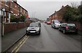
Station Road, Hereford
On the north side of Barton Road. This Station Road does not lead to the present-day Hereford railway station. The 19th century Hereford Barton railway station used to be nearby. The station closed in 1893.
Image: © Jaggery
Taken: 30 Jan 2017
0.04 miles
5
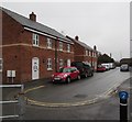
Station Road turning area, Hereford
Station Road ends here, about 70 metres north of Barton Road. This location is not near the present-day Hereford railway station. The 19th century Hereford Barton railway station used to be nearby. The station closed in 1893.
Image: © Jaggery
Taken: 30 Jan 2017
0.04 miles
6
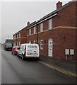
Hereford Gas Services van, Station Road, Hereford
The van is parked in Station Road near the Barton Road junction behind the camera.
This location is not near the present-day Hereford railway station. The 19th century Hereford Barton railway station used to be nearby. The station closed in 1893.
Image: © Jaggery
Taken: 30 Jan 2017
0.05 miles
7
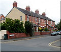
Stapleton Place, Station Road, Hereford
Viewed from Barton Road. The houses are alongside Station Road but the row is named Stapleton Place.
The name tablet http://www.geograph.org.uk/photo/5438606 on the wall between upstairs windows shows the year 1896.
Image: © Jaggery
Taken: 27 Aug 2012
0.05 miles
8
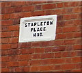
Victorian tablet on a Hereford wall
Showing STAPLETON PLACE 1896, the table is on the wall between two first-floor windows here. http://www.geograph.org.uk/photo/3519270
Image: © Jaggery
Taken: 30 Jan 2017
0.05 miles
9
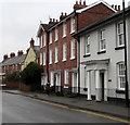
Grade II listed Barton Road house, Hereford
Fluted Doric columns are at the entrance to the house built in the early 19th century. Grade II listed in 1973.
Image: © Jaggery
Taken: 30 Jan 2017
0.05 miles
10
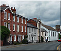
18-28 Barton Road, Hereford
Houses dating from the late C18th to mid C19th. The latter date probably applies to those of three storeys. No. 22 has a good porch (Image]). Grade II listed.
At the end is Barton Hall, built for the Plymouth Brethren by 1859.
Image: © Stephen Richards
Taken: 12 Aug 2013
0.05 miles