IMAGES TAKEN NEAR TO
Hay-on-Wye, HEREFORD, HR3 5RS
Introduction
This page details the photographs taken nearby to HR3 5RS by members of the Geograph project.
The Geograph project started in 2005 with the aim of publishing, organising and preserving representative images for every square kilometre of Great Britain, Ireland and the Isle of Man.

There are currently over 7.5m images from over14,400 individuals and you can help contribute to the project by visiting https://www.geograph.org.uk
Image Map
Images are licensed for reuse under creativecommons.org/licenses/by-sa/2.0
Notes
- Clicking on the map will re-center to the selected point.
- The higher the marker number, the further away the image location is from the centre of the postcode.
Image Listing (14 Images Found)
Images are licensed for reuse under creativecommons.org/licenses/by-sa/2.0
Image
Details
Distance
1
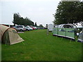
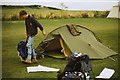
Radnor's End campsite north-west of Hay-on-Wye
If you're looking to camp in or very near Hay this is the place to pitch - small, family-friendly, warm and sheltered, cheap but with excellent facilities and well managed and run. A 5 minute walk into the centre of Hay or an even faster drive.
Image: © Jeremy Bolwell
Taken: 5 Sep 2010
0.04 miles
2
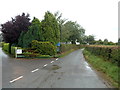
Entrance to Boatside Farm, near Hay-on-Wye
Image: © John Lord
Taken: 13 Sep 2013
0.05 miles
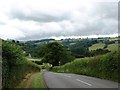
4
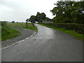
Single track road to Tirmynach north of Hay-on-Wye
Viewed from the road from Hay-on-Wye to Clyro.
The single track road ahead leads to Tirmynach (Monk's House). http://www.geograph.org.uk/photo/486083
The side road on the left is the entrance to Radnor's End Camping. http://www.geograph.org.uk/photo/2061372
Image: © Jaggery
Taken: 19 Aug 2012
0.09 miles
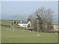
5
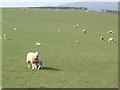
Spring pasture
Adjacent to Tir-mynach, near Hay-on-Wye.
Image: © Jonathan Billinger
Taken: 26 Mar 2007
0.11 miles
6
Riverside field, Hay-on-Wye
Viewed from a field gate at the edge of the B4351 near Hay Bridge. http://www.geograph.org.uk/photo/3087177
Image: © Jaggery
Taken: 10 Jun 2012
0.13 miles
7
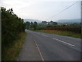
The B4351 road into Hay-on-Wye
The town rises on its crown of a hilltop on the other bank of the River Wye, its castle ruins and mansion overlooking the little border town in a stern and protective way.
Image: © Jeremy Bolwell
Taken: 5 Sep 2010
0.17 miles
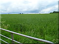
9
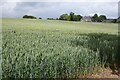
A field of wheat
A field of wheat beside Offa's Dyke Path near Hay-on-Wye.
Image: © Philip Halling
Taken: 11 Jun 2022
0.21 miles
10
Tir-mynach
Meaning Monk's House in welsh.
Image: © Jonathan Billinger
Taken: 26 Mar 2007
0.21 miles