
IMAGES TAKEN NEAR TO
Kings Caple, HEREFORD, HR1 4UN
Introduction
This page details the photographs taken nearby to HR1 4UN by members of the Geograph project.
The Geograph project started in 2005 with the aim of publishing, organising and preserving representative images for every square kilometre of Great Britain, Ireland and the Isle of Man.

There are currently over 7.5m images from over14,400 individuals and you can help contribute to the project by visiting https://www.geograph.org.uk
Image Map
Images are licensed for reuse under creativecommons.org/licenses/by-sa/2.0
Notes
- Clicking on the map will re-center to the selected point.
- The higher the marker number, the further away the image location is from the centre of the postcode.
Image Listing (134 Images Found)
Images are licensed for reuse under creativecommons.org/licenses/by-sa/2.0
Image
Details
Distance
1
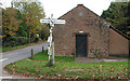
Former National School, King's Caple
A plaque informs us that this was once a Sunday and Lay School. King's Caple National School was erected in 1840 by public subscription. Now a small dwelling.
Image: © Pauline E
Taken: 1 Nov 2007
0.00 miles
2
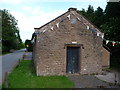
Old school in King's Caple
A Sunday and day school, dating from the 1840's and paid for by public subscription and bearing the inscription 'Lest we be without knowledge'. Touching, topical and timeless.
Image: © Jeremy Bolwell
Taken: 25 Jun 2012
0.01 miles
3
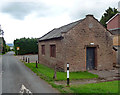
Former school, King's Caple
Rubble sandstone. A plaque records that it was a "Sunday and Day School / Built By Subscriptions / -1840- / LEST WE BE WITHOUT KNOWLEDGE". A neat, and now perhaps sometimes overlooked, encapsulation of the value of education.
Now used as a parish/community hall.
Image: © Stephen Richards
Taken: 13 Aug 2013
0.01 miles
4
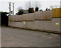
King's Caple electricity substation
In an enclosure on the east side of the village hall. http://www.geograph.org.uk/photo/4308516
Image: © Jaggery
Taken: 11 Jan 2015
0.01 miles
5
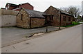
King's Caple Village Hall
Located in the Old School at the edge of crossroads in the centre of the village.
A plaque on the far side of the building http://www.geograph.org.uk/photo/3023864 shows
SUNDAY and DAY SCHOOL Built by Subscriptions 1840 LEST WE BE WITHOUT KNOWLEDGE.
Image: © Jaggery
Taken: 11 Jan 2015
0.01 miles
6
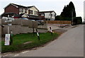
Crossroads signpost in the centre of King's Caple
On the SE side of crossroads. South (right) for Sellack Boat and a footbridge over the River Wye,
west for the village church and Ruxton, north for Hoarwithy, east for Fawley and How Caple.
Image: © Jaggery
Taken: 11 Jan 2015
0.02 miles
7
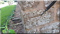
Kings Caple, Village Hall FBM
FBM on N/W angle of wall. Behind info board
Image: © V1ncenze
Taken: 29 Jul 2019
0.02 miles
8
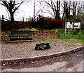
Bench and Millennium Stone in King's Caple
At crossroads in the centre of the village. The inscription on the stone is
KINGS CAPLE IN ARCHENFIELD 2000.
Image: © Jaggery
Taken: 11 Jan 2015
0.02 miles
9
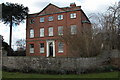
King's Caple Court
Imposing 18th century red brick house in the village of King's Caple.
Image: © Philip Halling
Taken: 25 Feb 2006
0.02 miles
10
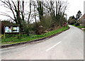
Village noticeboard, King's Caple
At crossroads in the centre of the village. A red phonebox http://www.geograph.org.uk/photo/4397663 is in the background.
Image: © Jaggery
Taken: 11 Jan 2015
0.02 miles