
IMAGES TAKEN NEAR TO
Kings Caple, HEREFORD, HR1 4TU
Introduction
This page details the photographs taken nearby to HR1 4TU by members of the Geograph project.
The Geograph project started in 2005 with the aim of publishing, organising and preserving representative images for every square kilometre of Great Britain, Ireland and the Isle of Man.

There are currently over 7.5m images from over14,400 individuals and you can help contribute to the project by visiting https://www.geograph.org.uk
Image Map
Images are licensed for reuse under creativecommons.org/licenses/by-sa/2.0
Notes
- Clicking on the map will re-center to the selected point.
- The higher the marker number, the further away the image location is from the centre of the postcode.
Image Listing (21 Images Found)
Images are licensed for reuse under creativecommons.org/licenses/by-sa/2.0
Image
Details
Distance
1
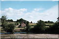
Aramstone Cottages
A view across the Wye to Aramstone Cottages. Biblett's Island is visible in the foreground, and is bigger than usual because the water level is so low.
Image: © John Winder
Taken: 15 Jun 2020
0.00 miles
2
Picnic by the river
A family group enjoy a picnic by the river on a sunny June day.
Image: © John Winder
Taken: 15 Jun 2020
0.01 miles
3
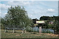
Picnic bench by the Wye
Most people, on this warm sunny day, had walked a few yards down the riverbank and sat on the grass instead of making use of the bench. The board details some of the wildlife you can see along this stretch of river.
Image: © John Winder
Taken: 15 Jun 2020
0.02 miles
4
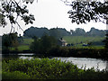
Riverside property
Looking across the Wye. The property higher up the slope is marked on the map as Aramstone, the lower property is Aramstone Cottage.
Image: © Pauline E
Taken: 21 Sep 2008
0.02 miles
5
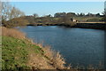
The River Wye upstream from Hoarwithy
The house on the opposite bank of the river is in a location marked as Aramstone on the OS map
Image: © Philip Halling
Taken: 28 Jan 2006
0.05 miles
6
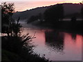
Sunset on the River Wye
An autumnal mist rises from the river near the village of Hoarwithy.
Image: © David Redwood
Taken: 10 Sep 2016
0.06 miles
8
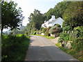
Outskirts of Hoarwithy
Entering the village from the Carey road with the River Wye to the left and Altbough Wood on the right. On the left is a footpath to the river with a sign that is very difficult to spot. (Not pictured.)
Image: © Pauline E
Taken: 21 Sep 2008
0.13 miles
9
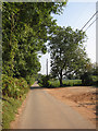
Road to Carey from Hoarwithy
River Wye to the right (SE), Altbough Wood to the left (NW). The road floods during very wet spells.
Image: © Pauline E
Taken: 21 Sep 2008
0.14 miles
10
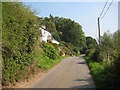
Between Altbough Wood and the River Wye
Some beautifully situated properties along this country road to Carey were seen on this sunny September morning.
Image: © Pauline E
Taken: 21 Sep 2008
0.14 miles