
IMAGES TAKEN NEAR TO
Brockhampton, HEREFORD, HR1 4SH
Introduction
This page details the photographs taken nearby to HR1 4SH by members of the Geograph project.
The Geograph project started in 2005 with the aim of publishing, organising and preserving representative images for every square kilometre of Great Britain, Ireland and the Isle of Man.

There are currently over 7.5m images from over14,400 individuals and you can help contribute to the project by visiting https://www.geograph.org.uk
Image Map
Images are licensed for reuse under creativecommons.org/licenses/by-sa/2.0
Notes
- Clicking on the map will re-center to the selected point.
- The higher the marker number, the further away the image location is from the centre of the postcode.
Image Listing (54 Images Found)
Images are licensed for reuse under creativecommons.org/licenses/by-sa/2.0
Image
Details
Distance
1
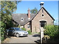
House at Ladyridge
This house used to be Brockhampton Parish school, built in 1875 as a mixed school. Parish records show the average attendance was 43 with Mrs Amelia Blythe as mistress.
Image: © Trevor Rickard
Taken: 26 Aug 2007
0.01 miles
2
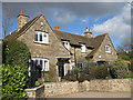
Solidly built cottages, Ladyridge
Close to the former Brockhampton Parish school, built in 1875 - now a dwelling.
Image: © Pauline E
Taken: 1 Mar 2009
0.01 miles
3
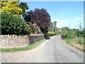
Lane at Ladyridge
Looking eastwards from the junction of the Wye Walley Walk off to the left.
Image: © Trevor Rickard
Taken: 26 Aug 2007
0.03 miles
4
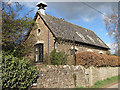
Former school, Brockhampton
Now a dwelling, this was Brockhampton Parish School, built in 1875.
Image: © Pauline E
Taken: 1 Mar 2009
0.03 miles
5
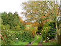
The Wye Valley Walk
A fine autumn morning at Ladyridge looking towards Capler Camp.
Don't think the cat wants to follow.
Image: © Jonathan Billinger
Taken: 6 Nov 2010
0.03 miles
6
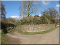
Wye Valley Walk
Bear left here for Capler Camp.
Image: © Pauline E
Taken: 1 Mar 2009
0.03 miles
7
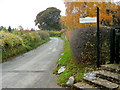
Ladyridge, Brinkley Hill
Lane heads south-west towards King's Capel.
Image: © Jonathan Billinger
Taken: 6 Nov 2010
0.04 miles
8
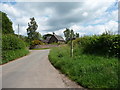
Path and lane junction
I assume that the building there is a converted schoolroom maybe.
Image: © Jeremy Bolwell
Taken: 19 Jun 2012
0.05 miles
9
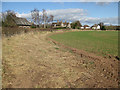
Ladyridge
View of the hamlet across a crop field.
Image: © Pauline E
Taken: 1 Mar 2009
0.05 miles
10
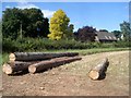
Logs at Ladyridge
Looking northwards from the footpath with the village in the background.
Image: © Trevor Rickard
Taken: 26 Aug 2007
0.06 miles