
IMAGES TAKEN NEAR TO
Clive Street, HEREFORD, HR1 2SB
Introduction
This page details the photographs taken nearby to Clive Street, HR1 2SB by members of the Geograph project.
The Geograph project started in 2005 with the aim of publishing, organising and preserving representative images for every square kilometre of Great Britain, Ireland and the Isle of Man.

There are currently over 7.5m images from over14,400 individuals and you can help contribute to the project by visiting https://www.geograph.org.uk
Image Map
Images are licensed for reuse under creativecommons.org/licenses/by-sa/2.0
Notes
- Clicking on the map will re-center to the selected point.
- The higher the marker number, the further away the image location is from the centre of the postcode.
Image Listing (112 Images Found)
Images are licensed for reuse under creativecommons.org/licenses/by-sa/2.0
Image
Details
Distance
1
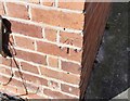
Ordnance Survey Cut Mark
This OS cut mark can be found on No7 Clive Street. It marks a point 54.696m above mean sea level.
Image: © Adrian Dust
Taken: 10 Mar 2019
0.01 miles
2
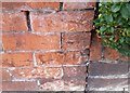
Ordnance Survey Cut Mark
This OS cut mark can be found on the wall of No47 Portfield Street. It marks a point 54.456m above mean sea level.
Image: © Adrian Dust
Taken: 10 Mar 2019
0.04 miles
3
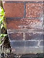
Ordnance Survey Cut Mark
This OS cut mark can be found on the wall of No16 Portfield Street. It marks a point 54.151m above mean sea level.
Image: © Adrian Dust
Taken: 10 Mar 2019
0.05 miles
4
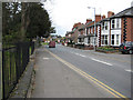
Ledbury Road, Hereford
This is the A438 heading NE.
Image: © Pauline E
Taken: 25 Mar 2008
0.06 miles
5
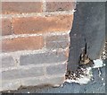
Ordnance Survey Cut Mark
This OS cut mark can be found on the wall of No8 Ledbury Road. It marks a point 53.584m above mean sea level.
Image: © Adrian Dust
Taken: 10 Mar 2019
0.06 miles
6
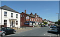
Eign Road, Hereford
Looking towards the junction with Clive Street. The shop on the corner specialises in confectionery and bakery supplies.
Image: © Jonathan Billinger
Taken: 9 Jun 2008
0.06 miles
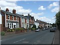
8
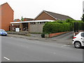
First Church Of Christ Scientist, Eign Road, Hereford
Image: © Peter Whatley
Taken: 30 Jun 2009
0.07 miles
9
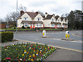
St. Owen Almshouses
Bearing inscriptions dated 1927 and 1931. At the junction of Eign Road and Ledbury Road.
Image: © Pauline E
Taken: 25 Mar 2008
0.08 miles
10
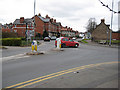
Eign Road junction with the A438, Hereford
Looking down St. Owen's Street. The red car is turning onto Ledbury Road. Behind the seat are the St. Giles's Hospital Almshouses.
Image: © Pauline E
Taken: 25 Mar 2008
0.08 miles