1
Park Street
Looking north-east from the junction with Hampton Street. This street is very aptly named and, although it is not a one-way street, there must be a code of practice for entering from this end to avoid jams. That said, the car in front of the white van was the only one pointing this way, perhaps a visitor!
Image: © Trevor Rickard
Taken: 7 Jun 2008
0.03 miles
2
Western end of Park Street, Bartonsham, Hereford
Viewed from Green Street.
Image: © Jaggery
Taken: 8 Jan 2015
0.04 miles
3
County Records Office
Home to the county archives. View of the entrance off Harold Street.
http://www.herefordshire.gov.uk/leisure/archives/3584.asp
Image: © Trevor Rickard
Taken: 7 Jun 2008
0.04 miles
4
Hereford TA Centre
Home to the Hereford Detachment of The Royal Mercian & Lancastrian Yeomanry, Royal Armoured Corps. View southwards across Harold Street.
http://www.tanearyou.org.uk/unitdetails.php?id=193
Image: © Trevor Rickard
Taken: 7 Jun 2008
0.04 miles
5
Former Militia Barracks, Harold Street
Also now the former County Record Office, which is off next year to Rotherwas and a fancy new building. Various Herefordshire regiments were based here from 1856 - the TA still operates from Suvla Barracks next door. There was a large drill hall here on what is now the car park of the adjacent TA centre. The small sign on the wall points to the Muster Point.
Image: © Philip Pankhurst
Taken: 18 Oct 2014
0.05 miles
6
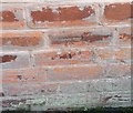
Ordnance Survey Cut Mark
This OS cut mark can be found on No118 Park Street. It marks a point 53.227m above mean sea level.
Image: © Adrian Dust
Taken: 10 Mar 2019
0.05 miles
7
Eign Road, Hereford
Image: © Peter Whatley
Taken: 30 Jun 2009
0.05 miles
8
Former Militia Barracks, Harold Street
Also now the former County Record Office, which is off next year to Rotherwas and a fancy new building. Various Herefordshire regiments were based here from 1856 - the TA still operates from Suvla Barracks next door. There was a large drill hall here on what is now the car park of the adjacent TA centre.
Image: © Philip Pankhurst
Taken: 18 Oct 2014
0.06 miles
9
Former Militia Barracks, Harold Street
Also now the former County Record Office, which is off next year to Rotherwas and a fancy new building. Various Herefordshire regiments were based here - the TA still operates from Suvla Barracks next door. There was a large drill hall here on what is now the car park of the TA centre next door.
Image: © Philip Pankhurst
Taken: 18 Oct 2014
0.06 miles
10
Eign Road, Hereford
Image: © Chris Whippet
Taken: 30 Jul 2015
0.07 miles


