IMAGES TAKEN NEAR TO
Tower Road, AMERSHAM, HP7 0LB

Introduction

This page details the photographs taken nearby to Tower Road, HP7 0LB by members of the Geograph project.

The Geograph project started in 2005 with the aim of publishing, organising and preserving representative images for every square kilometre of Great Britain, Ireland and the Isle of Man.

There are currently over 7.5m images from over14,400 individuals and you can help contribute to the project by visiting https://www.geograph.org.uk

Image Map


Images are licensed for reuse under creativecommons.org/licenses/by-sa/2.0
Notes
  • Clicking on the map will re-center to the selected point.
  • The higher the marker number, the further away the image location is from the centre of the postcode.

Image Listing (8 Images Found)

Images are licensed for reuse under creativecommons.org/licenses/by-sa/2.0
Image
Details
Distance
1
The bend in the road...
The bend in the road... once a dangerous series of four almost 90 degree bends, the road has been modified to one long sweeping curve - with a 90 degree turn at the end of it.
Image: © Colin Bates Taken: 21 Nov 2005
0.07 miles
2
?Tree island? near to Tower Road
Image: © Peter S Taken: 7 Feb 2014
0.17 miles
3
Path near Cherry Tree farm
Image: © Robert Eva Taken: 8 Oct 2016
0.18 miles
4
Coleshill and Rushymead from the air
The A413 road to the west of Amersham can be seen to the right of centre of the photo. Viewed from a Heathrow bound flight from Glasgow.
Image: © Thomas Nugent Taken: 10 Apr 2011
0.22 miles
5
The entrance to Rushymead care home
Image: © Ian S Taken: 12 Feb 2012
0.25 miles
6
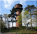
The converted water tower at Coleshill
Image: © Ian S Taken: 12 Feb 2012
0.25 miles
7
Coleshill Tower
Built as a water tower, now converted for residential purposes. The tower is quite a landmark, high up on the hillside to the south of Amersham.
Image: © Stefan Czapski Taken: 31 Mar 2013
0.25 miles
8
Coleshill Water Tower
Now converted into a private residence.
Image: © JThomas Taken: 13 Apr 2019
0.25 miles