IMAGES TAKEN NEAR TO
The Meads, BERKHAMSTED, HP4 3QX

Introduction

This page details the photographs taken nearby to The Meads, HP4 3QX by members of the Geograph project.

The Geograph project started in 2005 with the aim of publishing, organising and preserving representative images for every square kilometre of Great Britain, Ireland and the Isle of Man.

There are currently over 7.5m images from over14,400 individuals and you can help contribute to the project by visiting https://www.geograph.org.uk

Image Map


Images are licensed for reuse under creativecommons.org/licenses/by-sa/2.0
Notes
  • Clicking on the map will re-center to the selected point.
  • The higher the marker number, the further away the image location is from the centre of the postcode.

Image Listing (60 Images Found)

Images are licensed for reuse under creativecommons.org/licenses/by-sa/2.0
  • ...
Image
Details
Distance
1
Grand Union Canal at Northchurch
View from the bridge next to Northchurch Lock, looking to the South East towards Berkhamsted.
Image: © Chris Cole Taken: 25 Feb 2006
0.06 miles
2
Grand Union canal above Bushes Lock
Image: © Robert Eva Taken: 11 Feb 2018
0.06 miles
3
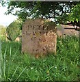
Grave of Peter the Wild Boy
Grave of Peter the Wild Boy at St Mary's Northchurch. Peter was found living wild in Germany in the early 1700s. He was brought to Britain on the orders of King George I's daughter-in-law Caroline of Ansbach, the Princess of Wales. He ended his days near to his grave. For more information please see http://en.wikipedia.org/wiki/Peter_the_Wild_Boy
Image: © Robert Matin Taken: 2 May 2009
0.07 miles
4
Cottages in the High Street, Northchurch
Notice the red and yellow reflective panel attached to the timber framing as a warning to drivers of large vehicles. The upper storey doesn't quite overhang the carriageway, but it comes close. The High Street is no longer part of the A41 (as it was for much of the 20th century) - so the worst threat to the building's survival has probably passed.
Image: © Stefan Czapski Taken: 7 Jul 2013
0.08 miles
5
Northchurch Almshouses
Also known as church house. The building dates from C15 and C16. See http://www.britishlistedbuildings.co.uk/en-355476-84-96-high-street-northchurch-hertfordsh for entry in British Listed Buildings
Image: © Bikeboy Taken: 2 Jan 2015
0.08 miles
6
Timber Framed House
Timber framed house in Northchurch.
Image: © Wayland Smith Taken: 18 Apr 2021
0.08 miles
7
St Mary's church, Northchurch
From the Grand Union Canal path
Image: © Robert Eva Taken: 11 Feb 2018
0.09 miles
8
St Mary's church, Northchurch
The oldest part of the church are the south and west walls which are C10 in origin. The church was extended between C11 and C14 and the tower was added C15. In 1880's further additions were made.
Image: © Bikeboy Taken: 2 Jan 2015
0.09 miles
9
Northchurch: The High Street
These half-timbered cottages, one with a jettied front, date from Tudor times. They appear idyllic, but this road was the busy arterial A41 until the Berkhamsted bypass was built, and although the road has now been downgraded to the A4251, the local traffic using it is still heavy. The tower of Image can be seen over the trees on the right.
Image: © Nigel Cox Taken: 21 Oct 2007
0.09 miles
10
St Mary's
Church in Northchurch, Berkhamsted.
Image: © Wayland Smith Taken: 18 Apr 2021
0.09 miles
  • ...