Northchurch: The High Street
Introduction
The photograph on this page of Northchurch: The High Street by Nigel Cox as part of the Geograph project.
The Geograph project started in 2005 with the aim of publishing, organising and preserving representative images for every square kilometre of Great Britain, Ireland and the Isle of Man.

There are currently over 7.5m images from over 14,400 individuals and you can help contribute to the project by visiting https://www.geograph.org.uk
Northchurch: The High Street
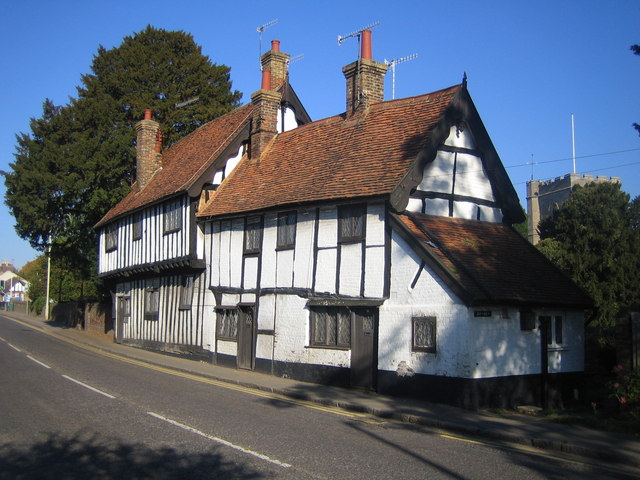
Image: © Nigel Cox Taken: 21 Oct 2007
These half-timbered cottages, one with a jettied front, date from Tudor times. They appear idyllic, but this road was the busy arterial A41 until the Berkhamsted bypass was built, and although the road has now been downgraded to the A4251, the local traffic using it is still heavy. The tower of Image can be seen over the trees on the right.
Images are licensed for reuse under creativecommons.org/licenses/by-sa/2.0
Image Location
Latitude
51.768514
Longitude
-0.589899