IMAGES TAKEN NEAR TO
Flaunden Park, HEMEL HEMPSTEAD, HP3 0PY
Introduction
This page details the photographs taken nearby to Flaunden Park, HP3 0PY by members of the Geograph project.
The Geograph project started in 2005 with the aim of publishing, organising and preserving representative images for every square kilometre of Great Britain, Ireland and the Isle of Man.

There are currently over 7.5m images from over14,400 individuals and you can help contribute to the project by visiting https://www.geograph.org.uk
Image Map
Images are licensed for reuse under creativecommons.org/licenses/by-sa/2.0
Notes
- Clicking on the map will re-center to the selected point.
- The higher the marker number, the further away the image location is from the centre of the postcode.
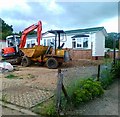
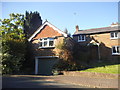
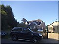
Image Listing (14 Images Found)
Images are licensed for reuse under creativecommons.org/licenses/by-sa/2.0
Image
Details
Distance
5
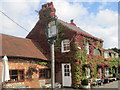
A colourful-looking Bricklayers Arms at Flaunden (2)
Image: © Peter S
Taken: 1 Sep 2015
0.19 miles
6
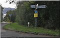
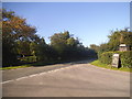
Crossroads on Flaunden Lane, Hogpits Bottom
Image: © David Howard
Taken: 17 Aug 2019
0.20 miles
7
A colourful-looking Bricklayers Arms at Flaunden (1)
Image: © Peter S
Taken: 1 Sep 2015
0.20 miles
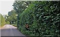
9
Hollyberry at the junction of Flaunden Lane
Image: © David Howard
Taken: 10 Sep 2015
0.20 miles
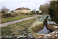
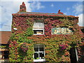
10
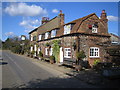
Hogpits Bottom: The Bricklayer's Arms Public House
On Hog Pits road and about 500 metres north of Flaunden village, the pub sign has a modern twist on an old theme.
Image: © Nigel Cox
Taken: 5 Mar 2006
0.21 miles