IMAGES TAKEN NEAR TO
Hemp Lane, TRING, HP23 6DW
Introduction
This page details the photographs taken nearby to Hemp Lane, HP23 6DW by members of the Geograph project.
The Geograph project started in 2005 with the aim of publishing, organising and preserving representative images for every square kilometre of Great Britain, Ireland and the Isle of Man.

There are currently over 7.5m images from over14,400 individuals and you can help contribute to the project by visiting https://www.geograph.org.uk
Image Map
Images are licensed for reuse under creativecommons.org/licenses/by-sa/2.0
Notes
- Clicking on the map will re-center to the selected point.
- The higher the marker number, the further away the image location is from the centre of the postcode.
Image Listing (14 Images Found)
Images are licensed for reuse under creativecommons.org/licenses/by-sa/2.0
Image
Details
Distance
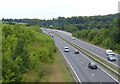
3
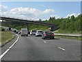
Hemp Lane bridge, A41
A tailback had developed due to a broken-down car blocking lane 1 ahead.
Image: © Peter Whatley
Taken: 19 Jun 2012
0.04 miles
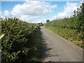
4
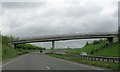
Hemp Lane bridge over the A41 ? site of a prehistoric temple?
The dual carriageway was built in the early 1990s and archaeological investigations at this point revealed a series of prehistoric parallel trenches which had been dug over a protracted period. No clear reason was found for the trenches but it was suggested they might have some religious significance.
Image: © Chris Reynolds
Taken: 5 May 2009
0.05 miles
5
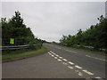
The A41 towards Tring
Viewed from the Hemp Lane Bridge.
Image: © Mat Fascione
Taken: 18 Aug 2015
0.09 miles
7
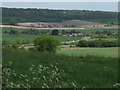
2000 years of travel through the Gap
This view across the Tring Gap in the Chilterns provides evidence of many years of travel.
The nearest road is the modern A41 – part of the Berkhamsted Bypass – constructed in the 1990s
Immediately beyond it, with a white van visible on the road, is the old A41. This was originally a Roman road, and it has been used ever since. In the 18th century it was part of the Sparrows Herne Turnpike road between Bushey and Aylesbury.
The farm is “New Ground Farm”
Beyond the farm there are glimpses of a low hedge which conceals the Grand Union Canal, which was opened in 1800.
One field beyond the canal is the London to Birmingham Railway, opened in 1837
The Chiltern Hills lie beyond the railway.
Image: © Chris Reynolds
Taken: 2 May 2009
0.14 miles
9
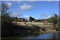
New Ground Farm from Grand Union Canal towing path
Image: © Robert Eva
Taken: 11 Feb 2018
0.16 miles
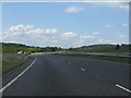
10
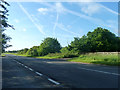
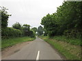
A4251 (former A41) near Wiggington
This stretch is mapped as on the course of Akeman Street, a Roman road.
Image: © Robin Webster
Taken: 25 May 2014
0.19 miles