2000 years of travel through the Gap
Introduction
The photograph on this page of 2000 years of travel through the Gap by Chris Reynolds as part of the Geograph project.
The Geograph project started in 2005 with the aim of publishing, organising and preserving representative images for every square kilometre of Great Britain, Ireland and the Isle of Man.

There are currently over 7.5m images from over 14,400 individuals and you can help contribute to the project by visiting https://www.geograph.org.uk
2000 years of travel through the Gap
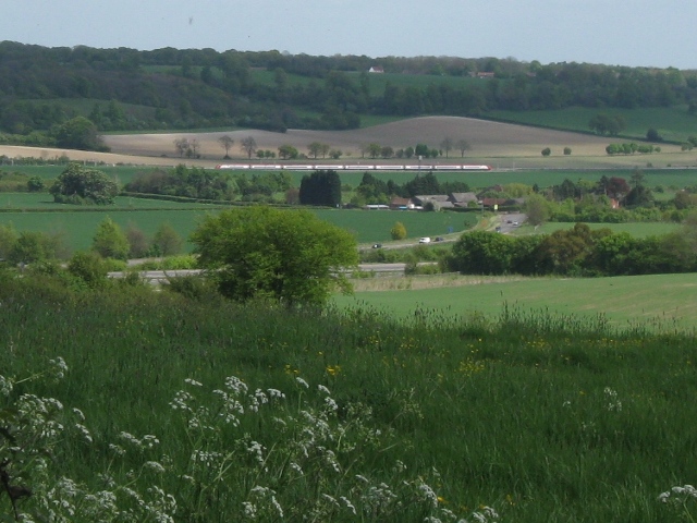
Image: © Chris Reynolds Taken: 2 May 2009
This view across the Tring Gap in the Chilterns provides evidence of many years of travel. The nearest road is the modern A41 – part of the Berkhamsted Bypass – constructed in the 1990s Immediately beyond it, with a white van visible on the road, is the old A41. This was originally a Roman road, and it has been used ever since. In the 18th century it was part of the Sparrows Herne Turnpike road between Bushey and Aylesbury. The farm is “New Ground Farm” Beyond the farm there are glimpses of a low hedge which conceals the Grand Union Canal, which was opened in 1800. One field beyond the canal is the London to Birmingham Railway, opened in 1837 The Chiltern Hills lie beyond the railway.
Images are licensed for reuse under creativecommons.org/licenses/by-sa/2.0
Image Location
Latitude
51.788353
Longitude
-0.625093