1
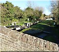
Bridge parapet and lock, Wilstone
Part of the parapet of Wilstone Bridge (No.3 on the Aylesbury Arm) cuts across in front of Jefferies Lock (No.8) just north of the village of Wilstone.
Image: © Rob Farrow
Taken: 19 Jan 2014
0.03 miles
2
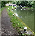
Jefferies Lock from under Wilstone Bridge
Taken from the towpath underneath Wilstone Bridge (No.3 on the Aylesbury Arm of the Grand Union Canal) looking eastwards into the open bottom gate of Jefferies Lock (No.8). The water level was very high after weeks of heavy rain which had caused flooding in some parts of the country (Jan 2014).
Image: © Rob Farrow
Taken: 19 Jan 2014
0.03 miles
3
Jefferies Lock, Aylesbury Arm
A view eastwards along the Aylesbury Arm of the Grand Union Canal from Wilstone Bridge - Bridge No.3 on this arm of the canal. As can be seen there is a lock by the bridge - this is known as Jefferies Lock (Lock No.8). There is another lock in the distance (Lock No.7) whose gates can be seen, this lock is roughly half way between Wilstone Bridge and Dixons Gap Bridge.
Image: © Rob Farrow
Taken: 19 Jan 2014
0.03 miles
4
Jefferies Lock , Wilstone - from the bridge
There is a lock immediately to the east of Bridge No.3 (Wilstone Bridge) on the Aylesbury Arm of the Grand Union Canal. The bridge carries Tring Road over the canal to the north of the village of Wilstone.
Image: © Rob Farrow
Taken: 19 Jan 2014
0.03 miles
5
The Tring reservoirs from the air
Seen just before entering the cloud blanket, Wilstone is the square reservoir in the centre of the photo. Startopsend reservoir, Marsworth Reservoir and Tringford reservoir can be seen towards the lower left corner.
All four reservoirs are owned by British Waterways and provide a water supply to the Grand Union Canal which can be seen diagonally crossing the lower right corner of the photo.
The reservoirs are a designated "Biological Site of Special Scientific Interest". They are important habitats for wildfowl and other wetland birds. This http://www.tringreservoirs.org.uk/p/history-of-reservoirs.html provide more information about the wildlife to be found there as well as a section on the history of the reservoirs.
Image: © Thomas Nugent
Taken: 29 Mar 2013
0.03 miles
6
Grand Union Canal
Locks on the Aylesbury Arm of the Grand Union Canal, just north of Wilstone.
Image: © David Griffiths
Taken: 30 Jun 2005
0.03 miles
7
Aylesbury Arm: Wilstone Lock (No 8)
Image: © Chris Reynolds
Taken: 14 Mar 2009
0.03 miles
8
Lock 8, Grand Junction Canal - Aylesbury Arm
Image: © Mr Biz
Taken: 27 Mar 2012
0.04 miles
9
Jefferies Lock No 8 on the Aylesbury Arm
Next to Tring Road Bridge No 3.
The Aylesbury Arm of the Grand Union Canal is six and a quarter miles long and has sixteen locks. It runs west from Marsworth Junction to the centre of Aylesbury.
Image: © Mat Fascione
Taken: 16 Aug 2015
0.04 miles
10
Aylesbury Arm: Wilstone Bridge (No 3)
Image: © Chris Reynolds
Taken: 14 Mar 2009
0.04 miles


