IMAGES TAKEN NEAR TO
Dunsmore, AYLESBURY, HP22 6QL
Introduction
This page details the photographs taken nearby to HP22 6QL by members of the Geograph project.
The Geograph project started in 2005 with the aim of publishing, organising and preserving representative images for every square kilometre of Great Britain, Ireland and the Isle of Man.

There are currently over 7.5m images from over14,400 individuals and you can help contribute to the project by visiting https://www.geograph.org.uk
Image Map (Loading...)


Getting Data...Please wait
Leaflet Map data © OpenStreetMap
Images are licensed for reuse under creativecommons.org/licenses/by-sa/2.0
Notes
- Clicking on the map will re-center to the selected point.
- The higher the marker number, the further away the image location is from the centre of the postcode.
Image Listing (9 Images Found)
Images are licensed for reuse under creativecommons.org/licenses/by-sa/2.0
Image
Details
Distance
1
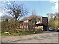
Modern house in Dunsmore
According to the sign it was built in 1969
Image: © David Howard
Taken: 14 Apr 2018
0.01 miles
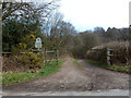
2
A way to Kimble and Princes Risborough
According to a signpost in Dunsmore.
Image: © Robin Webster
Taken: 27 Mar 2015
0.05 miles
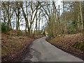
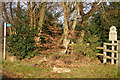
3
Track, Low Scrubs
At the high end of Low Scrubs, the National Trust property lies only to the left of the track. High Scrubs is to the right.
Image: © Robin Webster
Taken: 27 Mar 2015
0.12 miles
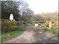
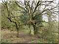
5
National Trust Low Scrubs
Footpath into National Trust Low Scrubs
Image: © Shaun Ferguson
Taken: 23 Dec 2007
0.14 miles
6
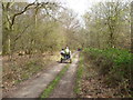
Track in the woodland near Coombe Hill, Bucks
A trotter passes, a great sight to see.
Image: © Jeremy Bolwell
Taken: 14 Apr 2019
0.14 miles
7
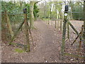
Footpath junction
A meeting of ways.
Image: © Jeremy Bolwell
Taken: 14 Apr 2019
0.16 miles
8
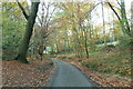
Unclassified road heading north-west through Fugsdon Wood
Image: © Dennis Troughton
Taken: 24 Nov 2005
0.17 miles
9
Path in the woods
Nice quiet pathway.
Image: © Jeremy Bolwell
Taken: 14 Apr 2019
0.20 miles