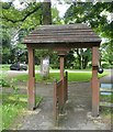
IMAGES TAKEN NEAR TO
William Burt Close, AYLESBURY, HP22 5QX

Introduction

This page details the photographs taken nearby to William Burt Close, HP22 5QX by members of the Geograph project.

The Geograph project started in 2005 with the aim of publishing, organising and preserving representative images for every square kilometre of Great Britain, Ireland and the Isle of Man.

There are currently over 7.5m images from over14,400 individuals and you can help contribute to the project by visiting https://www.geograph.org.uk

Image Map


Images are licensed for reuse under creativecommons.org/licenses/by-sa/2.0
Notes
  • Clicking on the map will re-center to the selected point.
  • The higher the marker number, the further away the image location is from the centre of the postcode.

Image Listing (38 Images Found)

Images are licensed for reuse under creativecommons.org/licenses/by-sa/2.0
  • ...
Image
Details
Distance
1
Weston Turville - North end of School Lane looking East
Image: © Mike Bean Taken: 31 Aug 2006
0.10 miles
2
Weston Turville - The brook
A view upstream along the brook which has flowed roughly northwards from Weston Turville reservoir. It is seen here as it is about to flow under Church Lane on the eastern outskirts of the village.
Image: © Rob Farrow Taken: 31 May 2014
0.12 miles
3
Green at West End, Weston Turville
Image: © Bikeboy Taken: 2 Jan 2015
0.14 miles
4
Thatched Cottage in School Lane, Weston Turville
26 School Lane dates back to the 17th century and is a timber framed building with painted plaster and brick infill. It was originally two cottages.
Image: © Chris Reynolds Taken: 16 Apr 2009
0.14 miles
5
Gable End of Thatched Cottage in School Lane
26 School Lane dates back to the 17th century and is a timber framed building with painted plaster and brick infill. It was originally two cottages.
Image: © Chris Reynolds Taken: 16 Apr 2009
0.16 miles
6
Weston Turville - North end of School Lane looking North West
Image: © Mike Bean Taken: 31 Aug 2006
0.17 miles
7
The Tapsell Gate Mechanism
See Image for more information on this lychgate.
Image: © Chris Reynolds Taken: 16 Apr 2009
0.20 miles
8
The Tapsell Lychgate at Weston Turville
The Lychgate of St Mary the Virgin is of a very unusual design and is a grade II listed building http://www.imagesofengland.org.uk/Details/Default.aspx?id=42895&mode=quick and has been renovated in 2006. The gate is mounted on a wooden post which is pivoted top and bottom and there is a weight and pulley mechanism to automatically close the gate Image . Gates of a similar design occur at Chalfont St Giles (Buckinghamshire) http://www.imagesofengland.org.uk/Details/Default.aspx?id=44397&mode=quick , Heston (Middlesex) http://www.imagesofengland.org.uk/Details/Default.aspx?id=202591&mode=quick and Burnsall (Yorkshire) http://www.skiptonweb.co.uk/gallery/picture.asp?id=1782 and Image . The Lychgate carries the plaque “This Tapsell Lychgate was faithfully renovated by Don Billing 2004.” Wikipedia has a page on the Tapsel or Tapsell lychgates of Sussex http://en.wikipedia.org/wiki/Tapsel_gate and it is clear that while these gates are resolve on a central post, the design is fundamentally different. The earliest gate in Sussex is believed to have been named after John Tapsel or Tapsell, probably in 1729. It seems that in 1896 the Heston gate was (incorrectly?) described as a Tapsel gate http://sac.pastfinders.org/sac_040.htm and since then the name has sometimes also been applied to gates closed with a chain, pulley and counterweight. See Image for general information about the church.
Image: © Chris Reynolds Taken: 16 Apr 2009
0.22 miles
9
Weston Turville - St.Mary's - "Tapsell" lychgate
This unusual lychgate is at the entrance to the grounds of St Mary's church in Weston Turville. It is of the "Tapsell" type which has a double width gate pivoted about a central pillar, and in this case counterbalanced by a weight to ease its operation. There is a small plaque on the gate stating that: "This Tapsell Lychgate was faithfully renovated by Don Billing 2004"
Image: © Rob Farrow Taken: 31 May 2014
0.22 miles
10
Weston Turville - St.Mary's - Tower
The tower of the Grade I listed http://list.english-heritage.org.uk/resultsingle.aspx?uid=1118358&searchtype=mapsearch St.Mary's church in Weston Turville. This C15th tower is somewhat younger than the rest of the church which dates mainly from the C13th and C14th, though containing an even earlier C12th "Aylesbury" font.
Image: © Rob Farrow Taken: 31 May 2014
0.22 miles
  • ...