Weston Turville - St.Mary's - Tower
Introduction
The photograph on this page of Weston Turville - St.Mary's - Tower by Rob Farrow as part of the Geograph project.
The Geograph project started in 2005 with the aim of publishing, organising and preserving representative images for every square kilometre of Great Britain, Ireland and the Isle of Man.

There are currently over 7.5m images from over 14,400 individuals and you can help contribute to the project by visiting https://www.geograph.org.uk
Weston Turville - St.Mary's - Tower
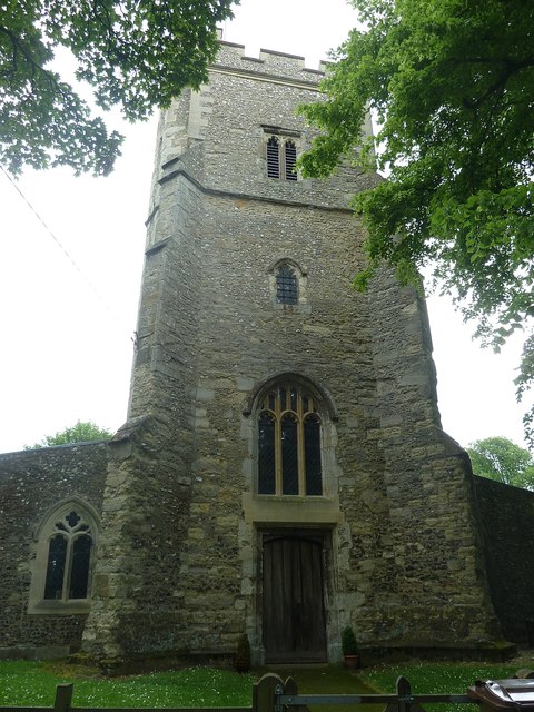
Image: © Rob Farrow Taken: 31 May 2014
The tower of the Grade I listed http://list.english-heritage.org.uk/resultsingle.aspx?uid=1118358&searchtype=mapsearch St.Mary's church in Weston Turville. This C15th tower is somewhat younger than the rest of the church which dates mainly from the C13th and C14th, though containing an even earlier C12th "Aylesbury" font.
Images are licensed for reuse under creativecommons.org/licenses/by-sa/2.0
Image Location
Latitude
51.784597
Longitude
-0.75612