IMAGES TAKEN NEAR TO
Upper Street, AYLESBURY, HP22 4BA
Introduction
This page details the photographs taken nearby to Upper Street, HP22 4BA by members of the Geograph project.
The Geograph project started in 2005 with the aim of publishing, organising and preserving representative images for every square kilometre of Great Britain, Ireland and the Isle of Man.

There are currently over 7.5m images from over14,400 individuals and you can help contribute to the project by visiting https://www.geograph.org.uk
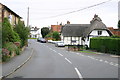
Image Map (107 Images)


Getting Data...Please wait
Leaflet Map data © OpenStreetMap
Images are licensed for reuse under creativecommons.org/licenses/by-sa/2.0
Notes
- Clicking on the map will re-center to the selected point.
- The higher the marker number, the further away the image location is from the centre of the postcode.
Image Listing (107 Images Found)
Images are licensed for reuse under creativecommons.org/licenses/by-sa/2.0
Image
Details
Distance
1
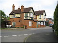
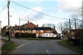
Quainton: Swan and Castle
This Greene King public house is in Lower Street, Quainton. Just under the eaves and to the left of the chimney breast is the date 1888, yet the Ordnance Survey 1:10,560 scale map Edition of 1883 shows the building and describes it by name. Curious. Maybe this is a rebuild of an earlier pub.
Image: © Nigel Cox
Taken: 3 May 2009
0.06 miles
2
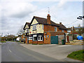
The Swan and Castle (closed), Quainton
An outbuilding has been demolished at the left, otherwise it is not too clear what is going on here.
Image: © Robin Webster
Taken: 27 Mar 2015
0.06 miles
3
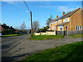
Modern houses in Quainton
The street to the right is Nash Close.
Image: © Humphrey Bolton
Taken: 30 Jan 2022
0.06 miles
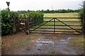
7
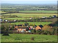
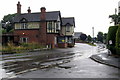
Houses, Quainton
A view over the North End Road area on the northwestern edge of the village.
Image: © Andrew Smith
Taken: 5 Jan 2008
0.13 miles
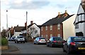
9
Lower street Quainton
Thatched cottage on Lower street Quainton
Image: © Shaun Ferguson
Taken: 21 Sep 2007
0.15 miles
10

Community Hall
The stone above the door reads:
SAVE AND SELF.
EDUCATIONAL FOUNDATION.
1911.
Among other activities, the building now houses a Table Tennis Club.
This building is entirely different from the village's Memorial Hall on Station Road.
Image: © Alan Murray-Rust
Taken: 23 Aug 2008
0.16 miles