Quainton: Swan and Castle
Introduction
The photograph on this page of Quainton: Swan and Castle by Nigel Cox as part of the Geograph project.
The Geograph project started in 2005 with the aim of publishing, organising and preserving representative images for every square kilometre of Great Britain, Ireland and the Isle of Man.

There are currently over 7.5m images from over 14,400 individuals and you can help contribute to the project by visiting https://www.geograph.org.uk
Quainton: Swan and Castle
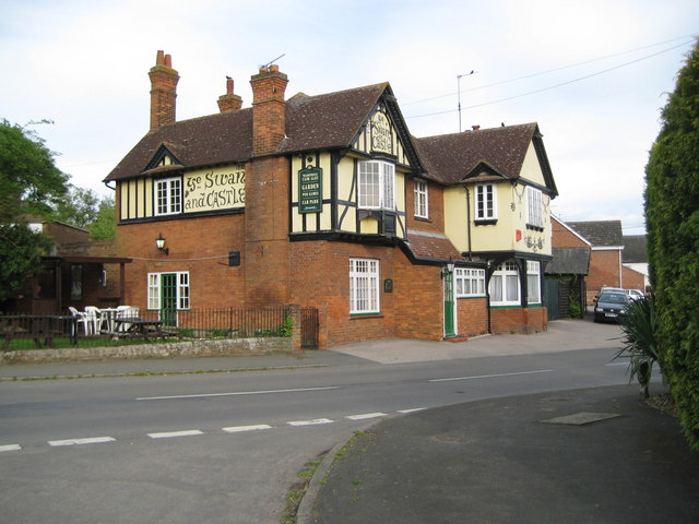
Image: © Nigel Cox Taken: 3 May 2009
This Greene King public house is in Lower Street, Quainton. Just under the eaves and to the left of the chimney breast is the date 1888, yet the Ordnance Survey 1:10,560 scale map Edition of 1883 shows the building and describes it by name. Curious. Maybe this is a rebuild of an earlier pub.
Images are licensed for reuse under creativecommons.org/licenses/by-sa/2.0
Image Location


Leaflet Map data © OpenStreetMap
Latitude
51.874892
Longitude
-0.922281