IMAGES TAKEN NEAR TO
Brill, AYLESBURY, HP18 9UJ
Introduction
This page details the photographs taken nearby to HP18 9UJ by members of the Geograph project.
The Geograph project started in 2005 with the aim of publishing, organising and preserving representative images for every square kilometre of Great Britain, Ireland and the Isle of Man.

There are currently over 7.5m images from over14,400 individuals and you can help contribute to the project by visiting https://www.geograph.org.uk
Image Map
Images are licensed for reuse under creativecommons.org/licenses/by-sa/2.0
Notes
- Clicking on the map will re-center to the selected point.
- The higher the marker number, the further away the image location is from the centre of the postcode.
Image Listing (12 Images Found)
Images are licensed for reuse under creativecommons.org/licenses/by-sa/2.0
Image
Details
Distance
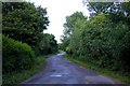
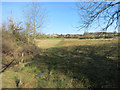
2
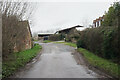
Lane at Touchbridge
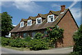
Touchbridge is a tiny settlement with a farm and a few cottages.
Image: © Bill Boaden
Taken: 27 Dec 2022
0.03 miles
3
The Bernwood Jubilee Way through Touchbridge
Image: © Steve Daniels
Taken: 7 Jun 2011
0.03 miles
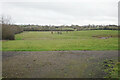
6
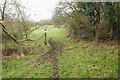
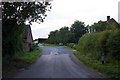
The footpath doesn't go this way
This used to be the route of the footpath down from Brill, but it has now been diverted onto the lane to the right.
Image: © Bill Boaden
Taken: 27 Dec 2022
0.10 miles
7
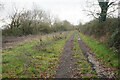
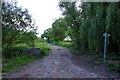
The northern end of Span Green
Northward from the car park in Image, the green lane is a proper dry track, which is a welcome improvement on the mud at the southern end.
Image: © Bill Boaden
Taken: 27 Dec 2022
0.13 miles
8
Only muddy down one side
Leaving some of the track OK to walk on.
Image: © Des Blenkinsopp
Taken: 22 Mar 2015
0.13 miles
9
A bit boggy on the Bernwood Way
Crossing a small stream on the way up to Brill.
Image: © Des Blenkinsopp
Taken: 22 Mar 2015
0.15 miles
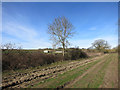
10
Grass field by Span Green
Google Maps shows a very interesting interlacing mowing pattern on this field, but I do not know what the field is used for. It has a car park in the foreground. Brill is on the top of the far hill.
Image: © Bill Boaden
Taken: 27 Dec 2022
0.18 miles