1
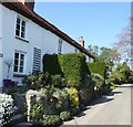
Road junction in Westlington
Image: © Roger Templeman
Taken: 9 Sep 2010
0.05 miles
2
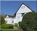
Cottages on Westlington Lane
The hamlet of Westlington adjoins the village of Dinton. Westlington Lane seen here links the two and has a number of very pretty cottages along it, many of them EH Grade II listed - see https://historicengland.org.uk/listing/the-list/list-entry/1118305 for example.
Image: © Rob Farrow
Taken: 20 Apr 2019
0.05 miles
3
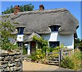
The Seven Stars, Dinton
Dating originally from the C17th, the Seven Stars is a Grade II listed https://historicengland.org.uk/listing/the-list/list-entry/1118311 public house set in the corner of New Road and Stars Lane in the very picturesque village of Dinton. It serves good food and ale. See their own website here http://www.sevenstarsdinton.com
Image: © Rob Farrow
Taken: 20 Apr 2019
0.07 miles
4
The Seven Stars, Dinton
The Seven Stars in Dinton is a very pleasant pub (serving a very good pint of Adnams Broadside I can report) in this lovely very well-maintained village.
Image: © Rob Farrow
Taken: 24 Sep 2006
0.07 miles
5
Wootton Farmhouse, Westlington, Dinton-with-Ford
Wootton Farmhouse on Westlington Lane dates originally from the C17th but was enlarged in the following century. See EH Grade II listing here https://historicengland.org.uk/listing/the-list/list-entry/1118306
Image: © Rob Farrow
Taken: 20 Apr 2019
0.07 miles
6
Westlington Farm, Dinton
Slightly confusingly, Westlington Farmhouse is situated in the village of Dinton rather than in the adjoining hamlet of Westlington.
The farmhouse dates from the C17th & C18th and is EH Grade II listed
https://historicengland.org.uk/listing/the-list/list-entry/1311252
Image: © Rob Farrow
Taken: 20 Apr 2019
0.08 miles
7
Farmhouse, Dinton, Buckinghamshire
Image: © Oswald Bertram
Taken: 9 Jul 2015
0.08 miles
8
Alleyway, Dinton
This little alleyway is part of a public footpath leading from Boot Lane round the back of Dinton Hall to come out on Ford Lane to the south of the church.
Image: © Rob Farrow
Taken: 20 Apr 2019
0.09 miles
9
La Chouette Restaurnt, Westlington, Dinton
Nearly 12 years since I took
Image] and I'm pleased to report that La Chouette Belgian Restaurant is still going strong. It is situated on the green in Westlington, a hamlet which is joined to the larger village of Dinton. They are both remarkably pretty villages with a host of thatched cottages.
La Chouette website here http://lachouette.co.uk
Image: © Rob Farrow
Taken: 7 May 2018
0.09 miles
10
Cottages across the Green, Westlington
The whole of the hamlet of Westlington (which adjoins the village of Dinton to the southwest of Aylesbury) is peppered with attractive cottages, many of them EH Grade II listed, e.g. https://historicengland.org.uk/listing/the-list/list-entry/1158905 and https://historicengland.org.uk/listing/the-list/list-entry/1118304
Image: © Rob Farrow
Taken: 20 Apr 2019
0.12 miles


