IMAGES TAKEN NEAR TO
Virginia Gardens, HIGH WYCOMBE, HP14 4JL

Introduction

This page details the photographs taken nearby to Virginia Gardens, HP14 4JL by members of the Geograph project.

The Geograph project started in 2005 with the aim of publishing, organising and preserving representative images for every square kilometre of Great Britain, Ireland and the Isle of Man.

There are currently over 7.5m images from over14,400 individuals and you can help contribute to the project by visiting https://www.geograph.org.uk

Image Map


Images are licensed for reuse under creativecommons.org/licenses/by-sa/2.0
Notes
  • Clicking on the map will re-center to the selected point.
  • The higher the marker number, the further away the image location is from the centre of the postcode.

Image Listing (20 Images Found)

Images are licensed for reuse under creativecommons.org/licenses/by-sa/2.0
Image
Details
Distance
1
Bledlow Ridge from hill above Slough Bottom Farm
The photo was inspired by the wisp of smoke, so seldom a feature of landscapes these days, now that chimneys are hardly used.
Image: © Ian Mulder Taken: 9 Jun 2007
0.04 miles
2
Houses with a view
Built on the side of the hill at Bledlow Ridge, these houses have backs with views towards West Wycombe.
Image: © Bill Boaden Taken: 20 Apr 2018
0.09 miles
3
Ridgeside, Bledlow Ridge
A new housing development built on the side of the ridge.
Image: © Bill Boaden Taken: 20 Apr 2018
0.10 miles
4
Ridgeside, Bledlow Ridge
A short but obvious street name as the land drops down from the top of Bledlow Ridge.
Image: © Des Blenkinsopp Taken: 7 Apr 2015
0.10 miles
5
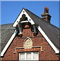
Old School, Bledlow Ridge
Date 1874 on the stone beneath the bell house. The new school is just behind.
Image: © Des Blenkinsopp Taken: 7 Apr 2015
0.12 miles
6
The Country Store, Bledlow Ridge
Village shop on Chinnor Road. In the foreground is a new house with a decorative brick and flint frontage. These were the traditional building materials round here for centuries. The style has been having a revival recently.
Image: © Des Blenkinsopp Taken: 7 Apr 2015
0.12 miles
7
Bledlow School Board 1874
On the wall of the old village school.
Image: © Des Blenkinsopp Taken: 7 Apr 2015
0.13 miles
8
Parish church, Bledlow Ridge
On older maps I notice that this church's little needle-spire is not sufficient to earn it the traditional orb-like 'church-with-spire' symbol. Photo taken on a showery August afternoon.
Image: © Stefan Czapski Taken: 26 Aug 2014
0.13 miles
9
St Paul's Church, Bledlow Ridge
A Grade II listed church dating from 1868.
Image: © Bill Boaden Taken: 20 Apr 2018
0.13 miles
10
St Paul's, Bledlow Ridge
Built in 1868
Image: © Bikeboy Taken: 7 Apr 2014
0.13 miles