IMAGES TAKEN NEAR TO
Retreat Lane, HIGH WYCOMBE, HP14 4AT
Introduction
This page details the photographs taken nearby to Retreat Lane, HP14 4AT by members of the Geograph project.
The Geograph project started in 2005 with the aim of publishing, organising and preserving representative images for every square kilometre of Great Britain, Ireland and the Isle of Man.

There are currently over 7.5m images from over14,400 individuals and you can help contribute to the project by visiting https://www.geograph.org.uk
Image Map (Loading...)


Getting Data...Please wait
Leaflet Map data © OpenStreetMap
Images are licensed for reuse under creativecommons.org/licenses/by-sa/2.0
Notes
- Clicking on the map will re-center to the selected point.
- The higher the marker number, the further away the image location is from the centre of the postcode.
Image Listing (8 Images Found)
Images are licensed for reuse under creativecommons.org/licenses/by-sa/2.0
Image
Details
Distance
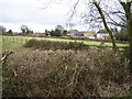
1
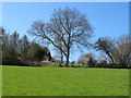
Pasture at Rout's Green
Looking up towards houses on Bledlow Ridge.
Image: © David Hawgood
Taken: 17 Apr 2010
0.04 miles
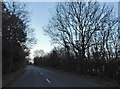
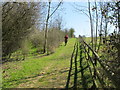
3
The Chiltern Way, Bledlow Ridge
Having just climbed up Bledlow Ridge, Chiltern Way walkers have a short section on the top along here before going all the way down again.
Image: © Des Blenkinsopp
Taken: 7 Apr 2015
0.12 miles
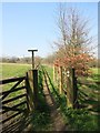
4
Footpath off Chinnor Road
Footpath off Chinnor Road by Routs Green
Image: © Shaun Ferguson
Taken: 25 Feb 2008
0.17 miles
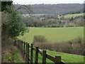
5
Houses on Routs Green, Bledlow Ridge
Bledlow Ridge is in the Chilterns and runs roughly SE/NW up to the escarpment. It is quite high (about 225M at this point) and quite exposed.
Image: © Graham Clutton
Taken: 1 Jan 2006
0.18 miles
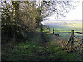
6
Chiltern Way by Bledlow Ridge
The path from Rout's Green is parallel to the ridge here.
Image: © David Hawgood
Taken: 17 Apr 2010
0.20 miles
8
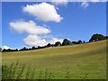
Hillside below Bledlow Ridge
Steep pasture rising from Radnage Lane above Radnage church.
Image: © Andrew Smith
Taken: 13 Jul 2008
0.24 miles