IMAGES TAKEN NEAR TO
Carver Hill Road, HIGH WYCOMBE, HP11 2UA
Introduction
This page details the photographs taken nearby to Carver Hill Road, HP11 2UA by members of the Geograph project.
The Geograph project started in 2005 with the aim of publishing, organising and preserving representative images for every square kilometre of Great Britain, Ireland and the Isle of Man.

There are currently over 7.5m images from over14,400 individuals and you can help contribute to the project by visiting https://www.geograph.org.uk
Image Map
Images are licensed for reuse under creativecommons.org/licenses/by-sa/2.0
Notes
- Clicking on the map will re-center to the selected point.
- The higher the marker number, the further away the image location is from the centre of the postcode.
Image Listing (15 Images Found)
Images are licensed for reuse under creativecommons.org/licenses/by-sa/2.0
Image
Details
Distance
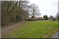
1
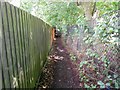
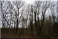
High Wycombe: Footpath between Marlow Road and Shelley Road
The hilly ground south of High Wycombe was criss-crossed with several public footpaths long before the houses, schools and factories arrived. However when they were built the old footpath routes were kept and this is one running between Marlow Road and Shelley Road, with the playing fields of Wycombe High School on the right.
Image: © Nigel Cox
Taken: 25 Jul 2015
0.06 miles
2
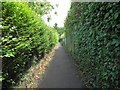
High Wycombe: Footpath between Marlow Road and Shelley Road
The hilly ground south of High Wycombe was criss-crossed with several public footpaths long before the houses, schools and factories arrived. However when they were built the old footpath routes were kept and this is one running between Marlow Road and Shelley Road, at the start of the long straight section just down from Marlow Road.
Image: © Nigel Cox
Taken: 25 Jul 2015
0.15 miles
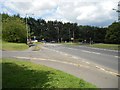
6
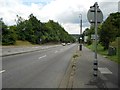
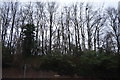
High Wycombe: A404 Marlow Hill
This is the view looking down the dead straight A404 Marlow Hill towards the town centre of High Wycombe. The old large scale Ordnance Survey mapping has a height of 222 feet at the bottom and 506 feet at the top, so it's a rise, or a fall, of about 284 feet or about 87 metres. This particular stretch, from the Daws Hill Lane junction in the distance up to the summit, is comparatively new. The old maps show the route swinging round in a roughly half-circular shape to the east in the past.
Image: © Nigel Cox
Taken: 25 Jul 2015
0.21 miles
10
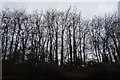
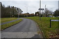
High Wycombe: Daws Hill Lane
This is the approach of Daws Hill Lane to its junction with the A404 Marlow Hill. The original route of Marlow Hill, before it was straightened, cut across the foreground here and followed the now dead-end road to the left.
Image: © Nigel Cox
Taken: 25 Jul 2015
0.22 miles