IMAGES TAKEN NEAR TO
Hedge Lea, HIGH WYCOMBE, HP10 0DA
Introduction
This page details the photographs taken nearby to Hedge Lea, HP10 0DA by members of the Geograph project.
The Geograph project started in 2005 with the aim of publishing, organising and preserving representative images for every square kilometre of Great Britain, Ireland and the Isle of Man.

There are currently over 7.5m images from over14,400 individuals and you can help contribute to the project by visiting https://www.geograph.org.uk
Image Map
Images are licensed for reuse under creativecommons.org/licenses/by-sa/2.0
Notes
- Clicking on the map will re-center to the selected point.
- The higher the marker number, the further away the image location is from the centre of the postcode.
Image Listing (26 Images Found)
Images are licensed for reuse under creativecommons.org/licenses/by-sa/2.0
Image
Details
Distance
2
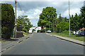
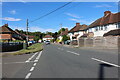
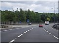
A4094 Boundary Road
Towards High Wycombe.
Image: © Robin Webster
Taken: 9 Jun 2019
0.04 miles
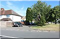
3
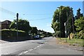
Boundary Road, Wooburn Green
At the corner of Revel Road.
Image: © David Howard
Taken: 10 Jul 2022
0.04 miles
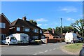
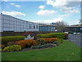
6
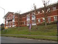
Offices on Boundary Road, Wooburn Green
Image: © David Howard
Taken: 8 Jan 2018
0.11 miles
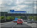
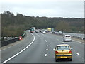
9
Knave's Beech
A business park in the shadow of the M40 at Loudwater. Tesco lorry flying overhead.
Image: © Jonathan Billinger
Taken: 7 Apr 2008
0.14 miles