IMAGES TAKEN NEAR TO
Park Gate, KNARESBOROUGH, HG5 9DR
Introduction
This page details the photographs taken nearby to Park Gate, HG5 9DR by members of the Geograph project.
The Geograph project started in 2005 with the aim of publishing, organising and preserving representative images for every square kilometre of Great Britain, Ireland and the Isle of Man.

There are currently over 7.5m images from over14,400 individuals and you can help contribute to the project by visiting https://www.geograph.org.uk
Image Map
Images are licensed for reuse under creativecommons.org/licenses/by-sa/2.0
Notes
- Clicking on the map will re-center to the selected point.
- The higher the marker number, the further away the image location is from the centre of the postcode.
Image Listing (99 Images Found)
Images are licensed for reuse under creativecommons.org/licenses/by-sa/2.0
Image
Details
Distance
1
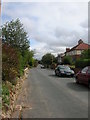
Edge of Scriven
This is one of the two roads into the village of Scriven from Knaresborough.
Image: © DS Pugh
Taken: 6 Sep 2006
0.01 miles
2
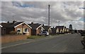
Park Gate, New Scriven
New Scriven forms the outer northwest suburb of Knaresborough. Some of these bungalows have a distinctive roofline.
Image: © Derek Harper
Taken: 5 Apr 2013
0.02 miles
3
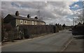
Pleasant Row, Scriven
A terrace of five cottages on Greengate Lane. Turning off immediately after them, and carrying with it the parish boundary between Scriven (left) and Knaresborough (ahead and down the lane), is the intriguingly-named Dumb Pots Lane.
Image: © Derek Harper
Taken: 5 Apr 2013
0.06 miles
4
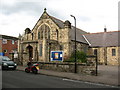
Park Grove Methodist Church
Methodist church and hall in a quiet area of Knaresborough.
Image: © Gordon Hatton
Taken: 30 Oct 2008
0.08 miles
5

A6055 near Park Gate
The road from Boroughbridge in Knaresborough.
Image: © DS Pugh
Taken: 1 Jan 2026
0.10 miles
6
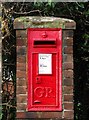
GR Postbox, Knaresborough
Box number HG5 207 beside Boroughbridge Road.
Image: © David Rogers
Taken: 23 Nov 2009
0.11 miles
7
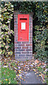
Post box, Boroughbridge Road (A6055), Knaresborough
This post box can be seen in context in Image
Image: © habiloid
Taken: 28 Oct 2020
0.12 miles
8
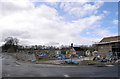
Disused farm buildings at the corner of Scriven Road and Greengate Lane
The wall running down Scriven Road once formed the boundary of the Slingsby family's parkland.
Image: © habiloid
Taken: 5 Apr 2008
0.12 miles
9
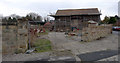
Old farm buildings at the corner of Scriven Road and Greengate Lane
Image: © habiloid
Taken: 10 Mar 2013
0.12 miles