
IMAGES TAKEN NEAR TO
Maythorpe Gardens, RIPON, HG4 5FB
Introduction
This page details the photographs taken nearby to Maythorpe Gardens, HG4 5FB by members of the Geograph project.
The Geograph project started in 2005 with the aim of publishing, organising and preserving representative images for every square kilometre of Great Britain, Ireland and the Isle of Man.

There are currently over 7.5m images from over14,400 individuals and you can help contribute to the project by visiting https://www.geograph.org.uk
Image Map
Images are licensed for reuse under creativecommons.org/licenses/by-sa/2.0
Notes
- Clicking on the map will re-center to the selected point.
- The higher the marker number, the further away the image location is from the centre of the postcode.
Image Listing (18 Images Found)
Images are licensed for reuse under creativecommons.org/licenses/by-sa/2.0
Image
Details
Distance
1
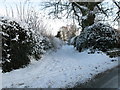
Back Lane, Sharow
Runs from New Road to Sharow Lane.
Image: © David Rogers
Taken: 6 Jan 2010
0.03 miles
2
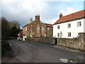
Village houses in Sharow
Period houses at the eastern end of the village. The further house displays a nice blend of building materials including brick, rubble, local limestone and odd bits of sandstone.
Image: © Gordon Hatton
Taken: 6 Jan 2008
0.05 miles
3
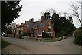
The Gate House
The Gate House is opposite the eastern entrance to Sharow Hall at the junction of New Road and Sharow Lane.
Image: © David Rogers
Taken: 21 Apr 2008
0.07 miles
5
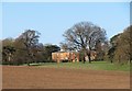
Sharow Hall
Very much a cross grid shot as the hall is not visible from any right of way nearer the building. The view is across ploughed land and then the hidden dry valley towards the parkland and house, which is attributed to John Carr and is late 18th century.
Image: © Gordon Hatton
Taken: 6 Apr 2020
0.10 miles
6
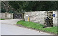
Village Pump
Sharow Village Pump on Sharow Lane is situated close to the junction of New Road. The blue sign states that the pump was restored by the parish council in 2002.
Image: © David Rogers
Taken: 21 Apr 2008
0.10 miles
7

Sharow Hall
A view of sunlit Sharow Hall from Lowfield Lane.
Image: © David Rogers
Taken: 13 Apr 2008
0.13 miles
8
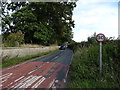
Dishforth Road
Heading out of Sharrow. Beside the estate wall of Lister House.
Image: © JThomas
Taken: 12 Sep 2020
0.15 miles
9
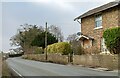
Sharow, Singleton Cottage
There is a benchmark cut into the boundary wall, also the roadside wall, of Singleton Cottage, which is on the north side of the lane.
Image: © Mel Towler
Taken: 13 Feb 2023
0.16 miles
10
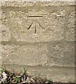
Sharow, Dishforth Road
The benchmark is cut into the boundary wall, also the roadside wall, of Singleton Cottage, which is on the north side of the lane.
Image: © Mel Towler
Taken: 13 Feb 2023
0.16 miles