Village Pump
Introduction
The photograph on this page of Village Pump by David Rogers as part of the Geograph project.
The Geograph project started in 2005 with the aim of publishing, organising and preserving representative images for every square kilometre of Great Britain, Ireland and the Isle of Man.

There are currently over 7.5m images from over 14,400 individuals and you can help contribute to the project by visiting https://www.geograph.org.uk
Village Pump
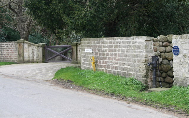
Image: © David Rogers Taken: 21 Apr 2008
Sharow Village Pump on Sharow Lane is situated close to the junction of New Road. The blue sign states that the pump was restored by the parish council in 2002.
Images are licensed for reuse under creativecommons.org/licenses/by-sa/2.0
Image Location


Leaflet Map data © OpenStreetMap
Latitude
54.139185
Longitude
-1.496386