IMAGES TAKEN NEAR TO
Aldermans Meadow, Quarry Moor Park, RIPON, HG4 3FD
Introduction
This page details the photographs taken nearby to Aldermans Meadow, Quarry Moor Park, HG4 3FD by members of the Geograph project.
The Geograph project started in 2005 with the aim of publishing, organising and preserving representative images for every square kilometre of Great Britain, Ireland and the Isle of Man.

There are currently over 7.5m images from over14,400 individuals and you can help contribute to the project by visiting https://www.geograph.org.uk
Image Map
Images are licensed for reuse under creativecommons.org/licenses/by-sa/2.0
Notes
- Clicking on the map will re-center to the selected point.
- The higher the marker number, the further away the image location is from the centre of the postcode.
Image Listing (27 Images Found)
Images are licensed for reuse under creativecommons.org/licenses/by-sa/2.0
Image
Details
Distance
2
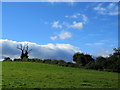
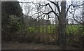
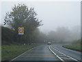
Pasture adjacent to Quarry House
Taken from a gap in the tangled vegetation beside the A61, it shows a pasture and hedgerow next to Quarry House.
Image: © Chris Heaton
Taken: 16 Oct 2012
0.07 miles
6
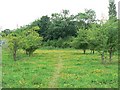
Meadow, Quarry Moor nature reserve, Ripon
With colour provided by Birds Foot Trefoil and Clover.
See Image]
Image: © Rich Tea
Taken: 8 Jul 2006
0.11 miles
7
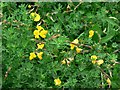
Birds Foot Trefoil, Quarry Moor nature reserve, Ripon
Detail of one of the flowers in the meadow - see Image]
Image: © Rich Tea
Taken: 8 Jul 2006
0.11 miles
8
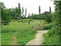
Quarry Moor nature reserve, Ripon
Looking towards Harrogate Road, which is behind the tall trees.
Image: © Rich Tea
Taken: 8 Jul 2006
0.13 miles
9
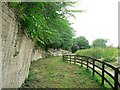
South end of quarry face, Quarry Moor, Ripon
This end is much smoother than the middle and north end. The sign nearby says that this was due to mechanical quarrying. Above the limestone are glacial drifts deposited towards the end of the last Ice Age.
Image: © Rich Tea
Taken: 8 Jul 2006
0.13 miles