IMAGES TAKEN NEAR TO
Gallows Hill Park, RIPON, HG4 1UL

Introduction

This page details the photographs taken nearby to Gallows Hill Park, HG4 1UL by members of the Geograph project.

The Geograph project started in 2005 with the aim of publishing, organising and preserving representative images for every square kilometre of Great Britain, Ireland and the Isle of Man.

There are currently over 7.5m images from over14,400 individuals and you can help contribute to the project by visiting https://www.geograph.org.uk

Image Map


Images are licensed for reuse under creativecommons.org/licenses/by-sa/2.0
Notes
  • Clicking on the map will re-center to the selected point.
  • The higher the marker number, the further away the image location is from the centre of the postcode.

Image Listing (25 Images Found)

Images are licensed for reuse under creativecommons.org/licenses/by-sa/2.0
  • ...
Image
Details
Distance
1
Postbox, Knaresborough Road, Ripon
Seen here in winter twilight, George VI postbox HG4 33 is by the junction with Littlethorpe Lane.
Image: © Derek Harper Taken: 27 Dec 2017
0.06 miles
2
Knaresborough Road
On the outskirts of Ripon.
Image: © DS Pugh Taken: 27 Dec 2015
0.08 miles
3
Benchmark cut into house wall, Ripon
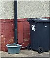
The benchmark is cut into the north east face of 26 Quarry Moor Road. The cutmark is to the left of the drainpipe. Wider view Image]
Image: © Mel Towler Taken: 1 Jun 2023
0.14 miles
4
26 Quarry Moor Road, Ripon
There is a benchmark cut into the north east face of 26 Quarry Moor Road. The cutmark is to the left of the drainpipe. Closer view Image]
Image: © Mel Towler Taken: 1 Jun 2023
0.14 miles
5
Entering Littlethorpe
Image: © Andrew Abbott Taken: 28 Aug 2010
0.14 miles
6
A61 near Littlethorpe
Image: © Andrew Abbott Taken: 28 Aug 2010
0.14 miles
7
Signs on the A61 near Littlethorpe
Image: © Andrew Abbott Taken: 28 Aug 2010
0.15 miles
8
Knaresborough Road meets the Ripon by-pass
In winter twilight.
Image: © Derek Harper Taken: 27 Dec 2017
0.15 miles
9
Sanctuary marker stone
Close to the by pass, this modern stone marks the site of a former sanctuary stone at a distance of a league from Ripon Minster. The only original stone is at Sharow in SE3271 and was in use for some 600 years from the tenth century.
Image: © Gordon Hatton Taken: 5 Jul 2014
0.16 miles
10
Ripon by-pass
The junction with Knaresborough Road (left) in winter twilight.
Image: © Derek Harper Taken: 27 Dec 2017
0.16 miles
  • ...