IMAGES TAKEN NEAR TO
South Stainley, HARROGATE, HG3 3LY
Introduction
This page details the photographs taken nearby to HG3 3LY by members of the Geograph project.
The Geograph project started in 2005 with the aim of publishing, organising and preserving representative images for every square kilometre of Great Britain, Ireland and the Isle of Man.

There are currently over 7.5m images from over14,400 individuals and you can help contribute to the project by visiting https://www.geograph.org.uk
Image Map
Images are licensed for reuse under creativecommons.org/licenses/by-sa/2.0
Notes
- Clicking on the map will re-center to the selected point.
- The higher the marker number, the further away the image location is from the centre of the postcode.
Image Listing (16 Images Found)
Images are licensed for reuse under creativecommons.org/licenses/by-sa/2.0
Image
Details
Distance
1
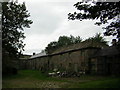
Cayton Hall Stables
Sad reflection of how a once fine stable yard has degenerated into disrepair
Image: © manonabike
Taken: 18 Sep 2006
0.04 miles
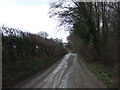
2
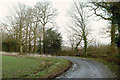
Bridleway to South Stainley
Getting gloomy as the day draws to an end. Bridleway 15 121/4/1 swings sharply to the left here.
Image: © Derek Harper
Taken: 22 Dec 2018
0.14 miles
3
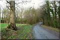
Approaching Shrog Wood
Bridleway 15 121/4/1 approaches the wood on the left, and the junction shown in Image
Image: © Derek Harper
Taken: 22 Dec 2018
0.16 miles
4
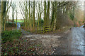
Tracks, Shrog Wood
The junction from where Image was taken; that shows the track on the left. On the right is Water Lane, carrying bridleway 15 121/4/1.
Image: © Derek Harper
Taken: 22 Dec 2018
0.17 miles
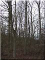
5
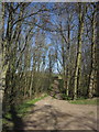
Track through Shrog Wood
A field access track heads through the narrow (60 metres wide) wood. Although I wouldn't guarantee the camera was exactly level, all these trees were definitely leaning to the east. Seen from Water Lane.
Image: © Derek Harper
Taken: 1 Apr 2012
0.18 miles
6
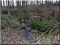
Shrog Wood
Drain at the head of Water Lane flows through Shrog Wood.
Image: © David Rogers
Taken: 1 Feb 2009
0.19 miles
8
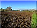
Ploughed Field by Water Lane
Country to the west of South Stainley
Image: © Chris Heaton
Taken: 7 Nov 2012
0.22 miles
10
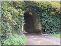
South Stainley benchmark
Benchmark on disused railway bridge, Harrogate/Ripon line. On RHS, 2 stones up.
Image: © Mel Towler
Taken: 9 May 2021
0.23 miles