IMAGES TAKEN NEAR TO
Brearton, HARROGATE, HG3 3DE
Introduction
This page details the photographs taken nearby to HG3 3DE by members of the Geograph project.
The Geograph project started in 2005 with the aim of publishing, organising and preserving representative images for every square kilometre of Great Britain, Ireland and the Isle of Man.

There are currently over 7.5m images from over14,400 individuals and you can help contribute to the project by visiting https://www.geograph.org.uk
Image Map
Images are licensed for reuse under creativecommons.org/licenses/by-sa/2.0
Notes
- Clicking on the map will re-center to the selected point.
- The higher the marker number, the further away the image location is from the centre of the postcode.
Image Listing (14 Images Found)
Images are licensed for reuse under creativecommons.org/licenses/by-sa/2.0
Image
Details
Distance
1
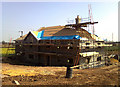
The Breeze Block House
A more modest brick built dwelling occupied this site until recently.
Image: © David Rogers
Taken: 10 Apr 2011
0.01 miles
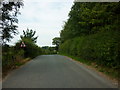
3
Brearton Lane
A sign and small lane near Nidd in North Yorkshire.
Image: © Dave Hunt
Taken: 25 Aug 2010
0.08 miles
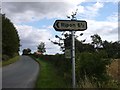
4
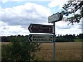
Signpost on Brearton Lane
A signpost with directions to Ripon and Brearton.
Image: © Dave Hunt
Taken: 25 Aug 2010
0.09 miles
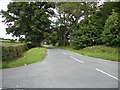
5
Junction of Brearton Lane and Green Lane
Green Lane (see http://www.geograph.org.uk/search.php?i=30923414 ) is to the right, signposted Ripon. Parish boundaries follow each lane.
Image: © Derek Harper
Taken: 1 Apr 2012
0.10 miles
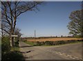
6
Green Lane
Green Lane as seen at the junction with Brearton Lane.
Image: © Dave Hunt
Taken: 25 Aug 2010
0.10 miles
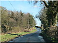
7
Brearton Lane near its junction with Green Lane
Looking eastward.
Image: © Peter Wood
Taken: 30 Dec 2018
0.11 miles
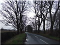
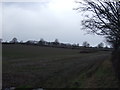
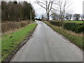
9
Junction ahead
Just beyond the second telegraph pole is the Green Lane junction, with Brearton Lane continuing ahead.
Image: © Gordon Hatton
Taken: 22 Jan 2021
0.12 miles