IMAGES TAKEN NEAR TO
Trafalgar Square, HARROGATE, HG3 2RB
Introduction
This page details the photographs taken nearby to Trafalgar Square, HG3 2RB by members of the Geograph project.
The Geograph project started in 2005 with the aim of publishing, organising and preserving representative images for every square kilometre of Great Britain, Ireland and the Isle of Man.

There are currently over 7.5m images from over14,400 individuals and you can help contribute to the project by visiting https://www.geograph.org.uk
Image Map (Loading...)


Getting Data...Please wait
Leaflet Map data © OpenStreetMap
Images are licensed for reuse under creativecommons.org/licenses/by-sa/2.0
Notes
- Clicking on the map will re-center to the selected point.
- The higher the marker number, the further away the image location is from the centre of the postcode.
Image Listing (14 Images Found)
Images are licensed for reuse under creativecommons.org/licenses/by-sa/2.0
Image
Details
Distance
1
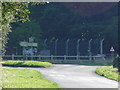
Road Junction outside HMS Forest Moor
Image: © Malcolm Street
Taken: 22 Sep 2005
0.08 miles
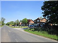
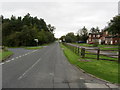
3
Houses along Menwith Hill Road
A bridleway leads off to the left to Meagill Lane.
Image: © DS Pugh
Taken: 3 Apr 2021
0.12 miles
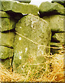
4
Old Waymarker Stone by Menwith Hill Road, Thornthwaite with Padside Parish
Menwith Hill cross, standing stone by the UC road, in parish of Thornthwaite with Padside (Harrogate District), West of B6451, Menwith Hill Road, set in wall at junction with Day Lane to Thornthwaite Bridge.
Surveyed
Milestone Society National ID: YNHG_THO
Image: © Milestone Society
Taken: Unknown
0.13 miles
5
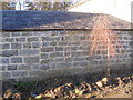
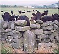
Guide Stone (close up); Thornthwaite Parish
Set in wall at the junction of Day Lane and Menwith Hill Road. Image
Image: © David Rogers
Taken: 16 Nov 2015
0.13 miles
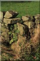
6
Old Guide Stone by Menwith Hill Road, Thornthwaite parish
Stone post by the UC road, in parish of Thornthwaite (Harrogate District), West of the B6451, Menwith Hill Road, set in wall at junction with Day Lane to Thornthwaite Bridge.
Surveyed
Milestone Society National ID: YN_XTHORa
Image: © Milestone Society
Taken: Unknown
0.13 miles
7
Guide Stone; Thornthwaite Parish
set in wall at the junction of Day Lane with Menwith Hill Road. Image
Image: © David Rogers
Taken: 16 Nov 2015
0.13 miles
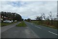
8
Menwith Hill Road by Forest Moor
Menwith Hill Road passing the Forest Moor Naval Base
Image: © Chris Heaton
Taken: 19 Sep 2011
0.14 miles
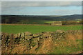
9
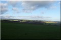
Farmland near Menwith Hill Road
Looking over farmland from the corner of Day Lane and Menwith Hill Road.
Image: © DS Pugh
Taken: 29 Dec 2015
0.14 miles