IMAGES TAKEN NEAR TO
Back Regent Place, HARROGATE, HG1 4QR
Introduction
This page details the photographs taken nearby to Back Regent Place, HG1 4QR by members of the Geograph project.
The Geograph project started in 2005 with the aim of publishing, organising and preserving representative images for every square kilometre of Great Britain, Ireland and the Isle of Man.

There are currently over 7.5m images from over14,400 individuals and you can help contribute to the project by visiting https://www.geograph.org.uk
Image Map
Images are licensed for reuse under creativecommons.org/licenses/by-sa/2.0
Notes
- Clicking on the map will re-center to the selected point.
- The higher the marker number, the further away the image location is from the centre of the postcode.
Image Listing (171 Images Found)
Images are licensed for reuse under creativecommons.org/licenses/by-sa/2.0
Image
Details
Distance
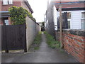
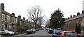
2
Regent Place - looking towards The Avenue
Image: © Betty Longbottom
Taken: 5 Apr 2017
0.03 miles
4
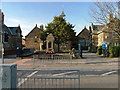
Starbeck Junior School and war memorial.
I tried all sorts of angles but could not get a shot round the tree. Must pack an axe with my camera. A lovely old solid stone built building typical of this area.
Image: © Robin Hall
Taken: 19 Nov 2005
0.05 miles
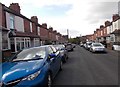
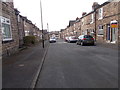
5
The Avenue, Starbeck
At the time of its development, which was around 1890/1900, this was one of the more desirable streets in the growing suburb of Starbeck, with stone built terraced villas to the left and brick built to the right. Starbeck grew initially as a separate community to Harrogate, being halfway between that developing spa town and Knaresborough. The railway reached here before a line was built into Harrogate and workers houses spread around a railway workshop area. Attempts to compete with Harrogate for spa facilities never came to fruition despite there being spa baths here offering sulphur treatment.
Image: © Gordon Hatton
Taken: 29 Mar 2018
0.06 miles
6
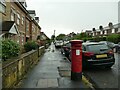
Edward VII postbox, The Avenue, Starbeck
Edward VII reigned from 1901-1910 which gives an indication of the date of the houses on the street (not those on the left of this photo which are obviously somewhat more recent).
Image: © Stephen Craven
Taken: 8 Jul 2023
0.06 miles
7
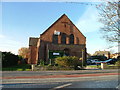
Starbeck Methodist Church
Unusual for this area, this church is brick built.
Image: © Robin Hall
Taken: 19 Nov 2005
0.07 miles
8
Pearl Street - looking towards The Avenue
Image: © Betty Longbottom
Taken: 5 Apr 2017
0.08 miles
9
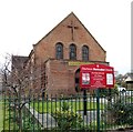
Starbeck Methodist Church
Located towards the eastern end of Starbeck High Street.
Image: © Gordon Hatton
Taken: 29 Mar 2018
0.08 miles
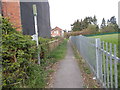
10
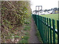
Footpath - looking towards Bogs Lane
Image: © Betty Longbottom
Taken: 5 Apr 2017
0.08 miles