IMAGES TAKEN NEAR TO
Southgate Fold, HOLMFIRTH, HD9 6PY
Introduction
This page details the photographs taken nearby to Southgate Fold, HD9 6PY by members of the Geograph project.
The Geograph project started in 2005 with the aim of publishing, organising and preserving representative images for every square kilometre of Great Britain, Ireland and the Isle of Man.

There are currently over 7.5m images from over14,400 individuals and you can help contribute to the project by visiting https://www.geograph.org.uk
Image Map
Images are licensed for reuse under creativecommons.org/licenses/by-sa/2.0
Notes
- Clicking on the map will re-center to the selected point.
- The higher the marker number, the further away the image location is from the centre of the postcode.
Image Listing (177 Images Found)
Images are licensed for reuse under creativecommons.org/licenses/by-sa/2.0
Image
Details
Distance
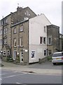
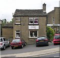
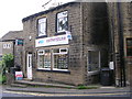
4
Yorkshire Building Society - Southgate
Image: © Betty Longbottom
Taken: 19 Jun 2010
0.03 miles
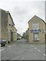
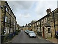
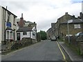
7
View from Old Turnpike, Honley
The old turnpike road to Holmfirth starts climbing more steeply that the new one, seen in this view. There are still many small industrial buildings in this part of the Holme valley.
Image: © Humphrey Bolton
Taken: 8 Jan 2009
0.05 miles
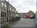
8
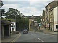
Eastgate, Honley
My mate Jed lived at the bottom of the hill.
Image: © Rob Taylor
Taken: 10 Aug 2005
0.05 miles
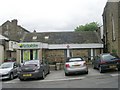
10
Cornerstone Estate Agents - Eastgate
Image: © Betty Longbottom
Taken: 19 Jun 2010
0.05 miles