IMAGES TAKEN NEAR TO
Woodhead Road, HOLMFIRTH, HD9 6PP
Introduction
This page details the photographs taken nearby to Woodhead Road, HD9 6PP by members of the Geograph project.
The Geograph project started in 2005 with the aim of publishing, organising and preserving representative images for every square kilometre of Great Britain, Ireland and the Isle of Man.

There are currently over 7.5m images from over14,400 individuals and you can help contribute to the project by visiting https://www.geograph.org.uk
Image Map
Images are licensed for reuse under creativecommons.org/licenses/by-sa/2.0
Notes
- Clicking on the map will re-center to the selected point.
- The higher the marker number, the further away the image location is from the centre of the postcode.
Image Listing (58 Images Found)
Images are licensed for reuse under creativecommons.org/licenses/by-sa/2.0
Image
Details
Distance
3
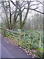
Entrance to Honley Wood
The public have free access, via the stile, to this small wood, which is owned by the Woodland Trust. See Image
Image: © Humphrey Bolton
Taken: 4 Dec 2014
0.06 miles
6
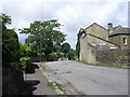
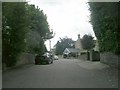
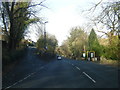
Far End Lane - viewed from Banks Road
Image: © Betty Longbottom
Taken: 17 Jul 2010
0.08 miles
7
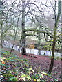
Beech tree in Honley Wood
The name 'Honley Wood' is perhaps a bit misleading, as it does not appear on old maps and the wood is very small, whilst Honley Wood towards Meltham to the west is large and well-known. It is owned by the Woodland Trust, who were given it by The Huddersfield Photographic and Antiquarian Society on the 18th March 1988. The public have free access, and it is shown as 'access' land on the 1:25000 map. There is a steep slippery slope down to the riverside, and the path that was created has become overgrown. This beech tree is mentioned in the management plan ( http://www.woodlandtrust.org.uk/woodfile/448/management-plan.pdf?cb=7589c2e02eaf4a07b67cbd3afa113129 ). There is a wooden platform in the tree, probably not installed by the Trust.
Image: © Humphrey Bolton
Taken: 4 Dec 2014
0.09 miles
8
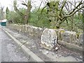
Milestone, Woodhead Road, Honley
Most of the turnpike milestones in the West Riding were replaced by the county council. This is a survivor. Almost illegible, but the 1850 map gives Huddersfield 4, Woodhead 9½.
Image: © Humphrey Bolton
Taken: 6 Mar 2008
0.10 miles
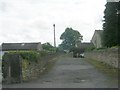
10
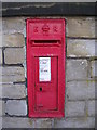
Edward VII Post Box - opposite No 37 Far End Lane
Image: © Betty Longbottom
Taken: 17 Jul 2010
0.11 miles