Milestone, Woodhead Road, Honley
Introduction
The photograph on this page of Milestone, Woodhead Road, Honley by Humphrey Bolton as part of the Geograph project.
The Geograph project started in 2005 with the aim of publishing, organising and preserving representative images for every square kilometre of Great Britain, Ireland and the Isle of Man.

There are currently over 7.5m images from over 14,400 individuals and you can help contribute to the project by visiting https://www.geograph.org.uk
Milestone, Woodhead Road, Honley
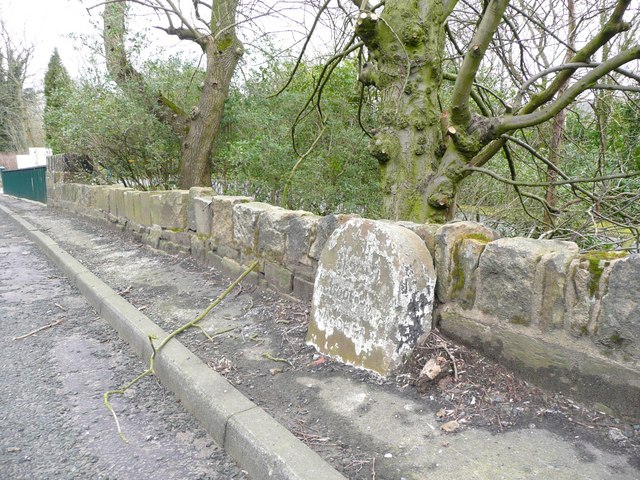
Image: © Humphrey Bolton Taken: 6 Mar 2008
Most of the turnpike milestones in the West Riding were replaced by the county council. This is a survivor. Almost illegible, but the 1850 map gives Huddersfield 4, Woodhead 9½.
Images are licensed for reuse under creativecommons.org/licenses/by-sa/2.0
Image Location


Leaflet Map data © OpenStreetMap
Latitude
53.599876
Longitude
-1.785391