1
A walk to Meltham Mills Reservoir 3
There is a rather muddy patch before the stile, and then FP38/8 comes alongside the wall towards the camera. FP37 turns right before the stile is reached.
Image: © Humphrey Bolton
Taken: 8 Mar 2017
0.07 miles
2
A walk to Meltham Mills Reservoir 4
The path goes over this stile at the side of a field gate.
Image: © Humphrey Bolton
Taken: 8 Mar 2017
0.09 miles
3
A walk to Meltham Mills Reservoir 5
This is a nice path, very obvious and with good views.
Image: © Humphrey Bolton
Taken: 8 Mar 2017
0.10 miles
4
A walk to Meltham Mills Reservoir 19 - driveway to Upper Cote Farm
Footpath 37/6 goes along this driveway, and should go through to Wood Nook Lane.
Image: © Humphrey Bolton
Taken: 8 Mar 2017
0.11 miles
5
A walk to Meltham Mills Reservoir 9 - view across the reservoir
Footpath 38/5 slants down the hillside, rather muddy in places, and there are views across the reservoir between the trees.
Image: © Humphrey Bolton
Taken: 8 Mar 2017
0.13 miles
6
A walk to Meltham Mills Reservoir 1, Knowl Lane
The walk started at a layby. The footpath signpost and stile are ahead, beyond the trees.
Image: © Humphrey Bolton
Taken: 8 Mar 2017
0.14 miles
7
A walk to Meltham Mills Reservoir 10 - path alongside the reservoir
This (FP38/6) seems to be a nicer path than the one that slants up the hillside, but involves a steep climb at the far end (which I have not investigated).
Image: © Humphrey Bolton
Taken: 8 Mar 2017
0.14 miles
8
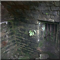
Interior of arched building at Lower Cote, Meltham
This is a view of the interior of the building shown in
Image The 1888 1:2500 map shows that this was part of a larger building, so that what appears to be a barred window would have communicated with another room or passage.
Image: © Humphrey Bolton
Taken: 10 Mar 2022
0.14 miles
9
Ruin of an arched building at Lower Cote, Meltham
Possibly a cool storage room. The floor is about a metre below the springer of the arch. See
Image] for a general view of the site.
Image: © Humphrey Bolton
Taken: 10 Mar 2022
0.14 miles
10
A walk to Meltham Mills Reservoir 7
This is the stile at the bottom of the field, now on FP38/7. The path turns west across a derelict field and then goes over a stone stile into woodland, between holly trees that need regular trimming.
Image: © Humphrey Bolton
Taken: 8 Mar 2017
0.14 miles


